Restaurants

American fine dining, steakhouse, taproom, and event venue

Tava House

Woodland Park restaurant and event venue serving American cuisine, with a Taproom, Firebrand steakhouse, River Room events space, and community Hub.

Quick Details
Location
120 S Center St, Woodland Park, CO 80863
Phone
719-428-5352
Last checked
2026-06-10
Rating
Yelp 4.3 (16 reviews); Tripadvisor 5.0 (1 review)
Hours
  • Taproom: daily 11am-9pm
  • Firebrand Steakhouse: Thursday-Sunday 5pm-9pm
  • River Room/events: available for bookings by phone or email
Reservations / Rooms
  • Taproom remains open seating.
  • Firebrand Steakhouse accepts table reservations through the official site.
  • River Room accepts weddings, banquets, private dinners, conferences, and special events; call 719-428-5352 or email events@tavahouse.com.

Taproom
Modern community bar with self-pour taps, cocktails, patio seating, and Pikes Peak views.

Firebrand · Reservable
Fine-dining chophouse inside Tava House; reservations accepted for dinner service.

River Room · Reservable
Reservable banquet, wedding, conference, and special-event room with mountain views.

Hub
Community events showcase for Woodland Park-area happenings.

Vegetarian Fit

Steakhouse-oriented menu with limited source-backed vegetarian options; verify before choosing it for a vegetarian guest.

  • Mushroom Cappuccino
  • House Caesar Salad
  • Grilled Asparagus with Bearnaise
Planning Notes
  • Official site links gift cards from the footer navigation.
  • Official site says Firebrand menu is still being refined and noted no fish service at the time checked; the local menu photo lists Fresh Fish of the Day, so verify availability before relying on that item.
  • Directions and contact forms are available from the official site.
  • Mushroom Cappuccino
  • House Caesar Salad
  • Grilled Asparagus with Bearnaise
Source Notes
  • Official website pages checked 2026-06-09: home, taproom, Firebrand, River Room, and weddings.
  • Saved Yelp PDF checked 2026-06-10: 4.3 rating from 16 reviews.
  • Saved Tripadvisor PDF checked 2026-06-10: 5.0 rating from 1 review.
Cajun and Creole counter-service restaurant

Perriteaux's Cajun Restaurant

Colorado Springs Cajun and Creole restaurant serving Louisiana-style gumbo, po' boys, etouffee, boils, beignets, and other New Orleans favorites.

Quick Details
Location
604 South Union Blvd., Colorado Springs, CO 80910
Phone
719-698-3012
Last checked
2026-06-10
Rating
Google-backed site reviews 4.3 (73 ratings); Yelp 2.5 (4 reviews); Local note: strong 4
Hours
  • Wed-Sun: 11am-8pm
  • Mon-Tue: Closed
Reservations / Rooms
  • Counter-service restaurant; the official site emphasizes order online, dine in, and takeout.
  • Official FAQ says plenty of parking is available.
  • Official site links catering for larger orders and events.
Vegetarian Fit

Cajun and Creole menu is meat/seafood-forward, but the official menu includes a few explicit vegetarian or vegan items.

  • Vegan Gumbo
  • Disco Fry Po' Boy
  • Cajun Poutine with vegetarian brown butter gravy
Planning Notes
  • Gazette article places Perriteaux's in the former Zorbadillos building across from Prospect Lake at Memorial Park.
  • Gazette article describes the restaurant as authentic Cajun and Creole cooking from Louisiana natives and chef Jason Miller.
  • Local note: local visitors have visited three times and both rate it a strong 4; local guest grew up in Baton Rouge until age 10.
  • Local note: Beignets and gumbo were good, Shrimp etouffee was phenomenal, service was top-notch, and the building is interesting and unique.
  • Local note: Portions felt small for the price; try the Bayou Sampler next.
  • Vegan Gumbo
  • Disco Fry Po' Boy
  • Cajun Poutine with vegetarian brown butter gravy
Source Notes
  • Official menu API and page checked 2026-06-10.
  • Official public /api/reviews checked 2026-06-10: 4.3 rating from 73 ratings.
  • Saved Yelp PDF checked 2026-06-10: 2.5 rating from 4 reviews.
  • Saved Colorado Springs Gazette PDF checked 2026-06-10 for restaurant background and location context.

Vegan fast-food restaurant

Santana's Vegan Grill

Colorado Springs vegan fast-food and drive-through restaurant with plant-based burgers, sandwiches, breakfast items, sides, desserts, and drinks.

Quick Details
Location
3220 Austin Bluffs Pkwy, Colorado Springs, CO 80918
Phone
(719) 694-9331
Last checked
2026-06-10
Rating
Restaurantji 4.5 (476 reviews)
Hours
  • Mon-Sat: 11am-6pm
  • Sun: Closed
Reservations / Rooms
  • Call or check the linked website before planning around reservations or ordering.
Vegetarian Fit

Saved sources identify Santana's as a vegan restaurant, making it the strongest fit for a vegetarian guest.

  • Vegan cuisine
  • Deluxe Burger
  • Deluxe Chicken Sandwich
  • Cinnamon Roll
Planning Notes
  • Restaurantji lists vegan cuisine and Mon-Sat daytime hours; confirm current hours before a longer drive.
  • Menu item names like chicken, bacon, and cheese are listed by Allmenus for Santana's Vegan Grill; source context identifies the restaurant as vegan.
  • Vegan cuisine
  • Deluxe Burger
  • Deluxe Chicken Sandwich
  • Cinnamon Roll
Source Notes
  • Direct official site links did not respond during the 2026-06-28 source pass.

Plant-forward cafe and restaurant

Adam's Mountain Cafe

Manitou Springs cafe with explicit vegan and vegetarian specialties, including breakfast, lunch, and dinner items.

Quick Details
Location
26 Manitou Ave, Manitou Springs, CO 80829
Phone
(719) 685-1430
Last checked
2026-06-10
Rating
Tripadvisor snippet 4.3 (871 reviews); Restaurant Guru snippet 4.9 (5,383 reviews)
Hours
  • Mon: 8am-2pm
  • Tue-Sat: 8am-2pm and 5pm-8pm
  • Sun: 8am-2pm
Reservations / Rooms
  • Call or check the linked website before planning around reservations or ordering.
Vegetarian Fit

Official sources explicitly position the cafe for vegan and vegetarian diners and list several vegan meals.

  • Vegan & Vegetarian Specialties
  • Vegan French Toast
  • Vegan Huevos Rancheros
  • Vegan Street Tacos
Planning Notes
  • Official menu says breakfast is served 8am-2pm daily and dinner is served Wednesday-Saturday.
  • Official structured hours list Tuesday-Saturday evening service; verify current dinner days before planning.
  • Vegan & Vegetarian Specialties
  • Vegan French Toast
  • Vegan Huevos Rancheros
  • Vegan Street Tacos

Ethiopian restaurant with vegan and vegetarian menu

Uchenna Ethiopian Restaurant

Old Colorado City Ethiopian restaurant whose official menu has a Vegan Paradise section with appetizers, stews, vegetable dishes, and a vegetarian combo.

Quick Details
Location
2501 W Colorado Ave #105, Colorado Springs, CO 80904
Phone
(719) 634-5070
Last checked
2026-06-10
Rating
Tripadvisor snippet 4.7 (616 reviews); official site embeds Google review snippets
Hours
  • Official home: Sunday & Monday closed
  • Official hours section: Tue-Fri lunch 11:30am-2pm, last order 1pm
  • Official hours section also lists Sat-Sun lunch 12pm-2pm, last order 1pm
Reservations / Rooms
  • Call or check the linked website before planning around reservations or ordering.
Vegetarian Fit

Official menu has a dedicated Vegan Paradise section and a vegetarian combo, making this a strong vegetarian pick.

  • Vegan Paradise
  • Vegetarian Combo
  • Misser Alecha
  • Misser Wat
  • Shiro Wat
  • Atakilt
Planning Notes
  • Official page says Sunday & Monday closed, but another official hours section lists Sunday lunch; call because Sunday conflicts with the closed note.
  • Official page describes the restaurant as a vegan and vegetarian paradise with gluten-free menus.
  • Vegan Paradise
  • Vegetarian Combo
  • Misser Alecha
  • Misser Wat
  • Shiro Wat
  • Atakilt

Gourmet mac and cheese restaurant

Mactory Gourmet Mac N Cheese

Colorado Springs mac-and-cheese restaurant where mac is the main dish, with a sourced veggie mac option and vegan-option signals.

Quick Details
Location
125 N Spruce St, Colorado Springs, CO 80905
Phone
(719) 722-2207
Last checked
2026-06-10
Rating
Restaurantji 4.8 (343 reviews)
Hours
  • Sun-Fri: 11am-8:45pm
  • Sat: Closed
Reservations / Rooms
  • Call or check the linked website before planning around reservations or ordering.
Vegetarian Fit

Strong flexible choice for a lacto-vegetarian guest: sourced menu evidence includes a veggie mac option, side vegetables, and vegan-option signals.

  • Garden Grove
  • Macnificent
  • Side Broccoli
  • Side Cauliflower
  • vegan options
Planning Notes
  • Restaurantji lists a Vegetarian category signal and vegan options tag, but not a full official allergen or vegetarian menu.
  • Saved Toast HTML lists Garden Grove as a veggie option and confirms Macnificent as the cheese-lover mac.
  • hello.food also shows side vegetables such as broccoli, cauliflower, and peas.
  • Saved Toast PDF is retained as a human-readable backup source.
  • The menu is mac-and-cheese-forward and includes many meat/seafood items, so this is a good flexible option rather than a strict vegetarian restaurant.
  • Garden Grove
  • Macnificent
  • Side Broccoli

Mexican restaurant

Fiesta Mexicana Restaurant Woodland Park

Woodland Park Mexican restaurant on W Midland Ave.

Quick Details
Location
420 W Midland Ave, Woodland Park, CO 80863
Phone
(719) 687-3551
Last checked
2026-06-10
Rating
Restaurantji 4.5 (490 reviews)
Hours
  • Daily: 11am-9pm
Reservations / Rooms
  • Call or check the linked website before planning around reservations or ordering.
Vegetarian Fit

Current saved sources show one named vegetarian entree; check the official menu before choosing it as the main vegetarian stop.

  • Vegetarian Burrito
Planning Notes
  • Vegetarian Burrito
Source Notes
  • Restaurantji detail page checked 2026-06-10: JSON-LD hours, phone, rating, cuisine, and menu image.
  • Restaurantji overview and Customers' Favorites text checked 2026-06-10 for menu highlights.
  • Official website link from Restaurantji detail page checked 2026-06-10.

Cafe, coffee, and breakfast restaurant

CAFE LEO

Woodland Park cafe on W Midland Ave.

Quick Details
Location
320 W Midland Ave, Woodland Park, CO 80863
Phone
(719) 687-6670
Last checked
2026-06-10
Rating
Restaurantji 4.6 (418 reviews)
Hours
  • Daily: 6am-6pm
Reservations / Rooms
  • Call or check the linked website before planning around reservations or ordering.
Vegetarian Fit

Cafe menu has several vegetarian breakfast/cafe items and an explicitly vegan muffin.

  • Everything Bagel with Cream Cheese
  • Vegan Blueberry Muffin
  • Pikes Peppermint Mocha
Planning Notes
  • No official website link was exposed on the Restaurantji detail page during this source pass.
  • Everything Bagel with Cream Cheese
  • Vegan Blueberry Muffin
  • Pikes Peppermint Mocha
Source Notes
  • Restaurantji detail page checked 2026-06-10: JSON-LD hours, phone, rating, cuisine, and menu image.
  • Restaurantji overview and Customers' Favorites text checked 2026-06-10 for menu highlights.

Bistro and whiskey house

Boards & Barrels Bistro & Whiskey House

Woodland Park bistro and whiskey house on US-24.

Quick Details
Location
19263 US-24, Woodland Park, CO 80863
Phone
(719) 687-8160
Last checked
2026-06-10
Rating
Restaurantji 4.7 (150 reviews)
Hours
  • Mon: Closed
  • Tue-Thu: 11am-9pm
  • Fri-Sat: 11am-10pm
  • Sun: 9:30am-2pm
Reservations / Rooms
  • Call or check the linked website before planning around reservations or ordering.
Vegetarian Fit

Current saved sources show boards and sides, but not enough vegetarian meal evidence for a guest recommendation.

Source Notes
  • Restaurantji detail page checked 2026-06-10: JSON-LD hours, phone, rating, cuisine, and menu image.
  • Restaurantji overview and Customers' Favorites text checked 2026-06-10 for menu highlights.
  • Official website link from Restaurantji detail page checked 2026-06-10.

Burgers and grill restaurant

Judge's Char-Grill

Woodland Park char-grill restaurant on Morning Sun Dr.

Quick Details
Location
100 Morning Sun Dr, Woodland Park, CO 80863
Phone
(719) 687-8155
Last checked
2026-06-10
Rating
Restaurantji 4.4 (529 reviews)
Hours
  • Mon-Sat: 11am-9pm
  • Sun: 11am-8pm
Reservations / Rooms
  • Call or check the linked website before planning around reservations or ordering.
Vegetarian Fit

Burger spot with a sourced black bean burger, but limited vegetarian range in the current saved source pass.

  • Black Bean Burger
Planning Notes
  • Black Bean Burger
Source Notes
  • Restaurantji detail page checked 2026-06-10: JSON-LD hours, phone, rating, cuisine, and menu image.
  • Restaurantji overview and Customers' Favorites text checked 2026-06-10 for menu highlights.
  • Official website link from Restaurantji detail page checked 2026-06-10.

Chinese restaurant

Fortune Dragon

Woodland Park Chinese restaurant on US-24.

Quick Details
Location
280 US-24, Woodland Park, CO 80863
Phone
(719) 687-8883
Last checked
2026-06-10
Rating
Restaurantji 4.6 (216 reviews)
Hours
  • Mon-Fri: 11am-9:30pm
  • Sat: 11am-10pm
  • Sun: 11am-9pm
Reservations / Rooms
  • Call or check the linked website before planning around reservations or ordering.
Vegetarian Fit

Current saved sources do not show vegetarian or tofu dishes; verify the current menu before recommending it.

Planning Notes
  • No official website link was exposed on the Restaurantji detail page during this source pass.
Source Notes
  • Restaurantji detail page checked 2026-06-10: JSON-LD hours, phone, rating, cuisine, and menu image.
  • Restaurantji overview and Customers' Favorites text checked 2026-06-10 for menu highlights.

Homestyle American and breakfast restaurant

Grandmother's Kitchen

Woodland Park homestyle restaurant on US-24.

Quick Details
Location
212 US-24, Woodland Park, CO 80863
Phone
(719) 687-6899
Last checked
2026-06-10
Rating
Restaurantji 4.3 (374 reviews)
Hours
  • Mon: Closed
  • Tue-Wed: 6am-2pm
  • Thu: Closed
  • Fri-Sun: 6am-2pm
Reservations / Rooms
  • Call or check the linked website before planning around reservations or ordering.
Vegetarian Fit

Current saved sources do not show enough vegetarian meal evidence, and the green chili should not be assumed vegetarian.

Planning Notes
  • No official website link was exposed on the Restaurantji detail page during this source pass.
Source Notes
  • Restaurantji detail page checked 2026-06-10: JSON-LD hours, phone, rating, cuisine, and menu image.
  • Restaurantji overview and Customers' Favorites text checked 2026-06-10 for menu highlights.

Chinese restaurant

Mayflower Chinese Restaurant

Woodland Park Chinese restaurant on US-24.

Quick Details
Location
1212 US-24, Woodland Park, CO 80863
Phone
(719) 687-0711
Last checked
2026-06-10
Rating
Restaurantji 4.4 (189 reviews)
Hours
  • Mon: Closed
  • Tue-Sun: 11am-9pm
Reservations / Rooms
  • Call or check the linked website before planning around reservations or ordering.
Vegetarian Fit

Current saved sources do not show vegetarian or tofu dishes; verify the current menu before recommending it.

Source Notes
  • Restaurantji detail page checked 2026-06-10: JSON-LD hours, phone, rating, cuisine, and menu image.
  • Restaurantji overview and Customers' Favorites text checked 2026-06-10 for menu highlights.
  • Official website link from Restaurantji detail page checked 2026-06-10.

Indian restaurant

Turmeric Indian Cuisine at Power Center Point

Colorado Springs Indian restaurant at Powers Center Point.

Quick Details
Location
5535 Powers Center Point, Colorado Springs, CO 80920
Phone
(719) 308-2514
Last checked
2026-06-10
Rating
Restaurantji 4.9 (284 reviews)
Hours
  • Mon: 12pm-9pm
  • Tue: Closed
  • Wed-Sun: 12pm-9pm
Reservations / Rooms
  • Call or check the linked website before planning around reservations or ordering.
Vegetarian Fit

Indian menu highlights include multiple meatless dishes, making this a strong vegetarian first pick.

  • Gobi Manchurian
  • Garlic Naan
Planning Notes
  • Gobi Manchurian
  • Garlic Naan
Source Notes
  • Restaurantji detail page checked 2026-06-10: JSON-LD hours, phone, rating, cuisine, and menu image.
  • Restaurantji overview and Customers' Favorites text checked 2026-06-10 for menu highlights.
  • Official website link from Restaurantji detail page checked 2026-06-10.

Indian restaurant

Shri Ganesh

Colorado Springs Indian restaurant on Ridgeline Dr.

Quick Details
Location
11550 Ridgeline Dr #128, Colorado Springs, CO 80921
Phone
(719) 419-7156
Last checked
2026-06-10
Rating
Restaurantji 4.8 (508 reviews)
Hours
  • Mon-Sat: 11am-9pm
  • Sun: Closed
Reservations / Rooms
  • Call or check the linked website before planning around reservations or ordering.
Vegetarian Fit

Indian menu highlights include several vegetarian dishes, making this a strong vegetarian first pick.

  • Vegetable Samosa
  • Chana Chaat
Planning Notes
  • Vegetable Samosa
  • Chana Chaat
Source Notes
  • Restaurantji detail page checked 2026-06-10: JSON-LD hours, phone, rating, cuisine, and menu image.
  • Restaurantji overview and Customers' Favorites text checked 2026-06-10 for menu highlights.
  • Official website link from Restaurantji detail page checked 2026-06-10.

African restaurant

ArkCleoRich African Kitchen

Colorado Springs African restaurant on N Academy Blvd.

Quick Details
Location
1371 N Academy Blvd, Colorado Springs, CO 80909
Phone
(347) 207-6327
Last checked
2026-06-10
Rating
Restaurantji 4.8 (446 reviews)
Hours
  • Mon: Closed
  • Tue-Sun: 11am-8:30pm
Reservations / Rooms
  • Call or check the linked website before planning around reservations or ordering.
Vegetarian Fit

Current saved sources name plantains and rice dishes, but do not confirm a meatless meal path.

Source Notes
  • Restaurantji detail page checked 2026-06-10: JSON-LD hours, phone, rating, cuisine, and menu image.
  • Restaurantji overview and Customers' Favorites text checked 2026-06-10 for menu highlights.
  • Official website link from Restaurantji detail page checked 2026-06-10.

Fondue restaurant

Melting Pot

Colorado Springs fondue restaurant downtown on E Pikes Peak Ave.

Quick Details
Location
30 E Pikes Peak Ave Suite A, Colorado Springs, CO 80903
Phone
(719) 385-0300
Last checked
2026-06-10
Rating
Restaurantji 4.7 (1,061 reviews)
Hours
  • Mon-Fri: 4pm-10pm
  • Sat: 12pm-10pm
  • Sun: 12pm-9pm
Reservations / Rooms
  • Call or check the linked website before planning around reservations or ordering.
Vegetarian Fit

Fondue menu highlights include cheese and dessert fondue options that can work for vegetarian diners; verify entree details before planning around a full dinner.

  • Cheese Fondue
  • Chocolate Fondue
  • Banana Foster Fondue
Planning Notes
  • Cheese Fondue
  • Chocolate Fondue
  • Banana Foster Fondue
Source Notes
  • Restaurantji detail page checked 2026-06-10: JSON-LD hours, phone, rating, cuisine, and menu image.
  • Restaurantji overview and Customers' Favorites text checked 2026-06-10 for menu highlights.
  • Official website link from Restaurantji detail page checked 2026-06-10.

Jamaican restaurant

PETES Jamaican restaurant

Colorado Springs Jamaican restaurant on S Nevada Ave.

Quick Details
Location
1107 S Nevada Ave, Colorado Springs, CO 80903
Phone
(719) 900-1718
Last checked
2026-06-10
Rating
Restaurantji 4.9 (245 reviews)
Hours
  • Mon: Closed
  • Tue-Sat: 11am-8pm
  • Sun: Closed
Reservations / Rooms
  • Call or check the linked website before planning around reservations or ordering.
Vegetarian Fit

Current saved sources are meat-heavy and do not show a vegetarian meal path.

Planning Notes
  • No official website link was exposed on the Restaurantji detail page during this source pass.
Source Notes
  • Restaurantji detail page checked 2026-06-10: JSON-LD hours, phone, rating, cuisine, and menu image.
  • Restaurantji overview and Customers' Favorites text checked 2026-06-10 for menu highlights.

Korean restaurant

Momo Korean Restaurant

Colorado Springs Korean restaurant on Briargate Blvd.

Quick Details
Location
2761 Briargate Blvd, Colorado Springs, CO 80920
Phone
(719) 203-6963
Last checked
2026-06-10
Rating
Restaurantji 4.9 (252 reviews)
Hours
  • Mon: Closed
  • Tue-Sat: 4:30pm-9pm
  • Sun: Closed
Reservations / Rooms
  • Call or check the linked website before planning around reservations or ordering.
Vegetarian Fit

Current saved sources name Korean dishes but do not confirm vegetarian versions.

Source Notes
  • Restaurantji detail page checked 2026-06-10: JSON-LD hours, phone, rating, cuisine, and menu image.
  • Restaurantji overview and Customers' Favorites text checked 2026-06-10 for menu highlights.
  • Official website link from Restaurantji detail page checked 2026-06-10.

Sushi and Japanese restaurant

Sushi Spot

Colorado Springs sushi restaurant on S 8th St.

Quick Details
Location
308 S 8th St Unit M, Colorado Springs, CO 80904
Phone
(719) 358-7241
Last checked
2026-06-10
Rating
Restaurantji 4.8 (340 reviews)
Hours
  • Mon-Thu: 11am-3pm, 4:30pm-9pm
  • Fri: 11am-3pm, 4:30pm-10pm
  • Sat: 11am-10pm
  • Sun: Closed
Reservations / Rooms
  • Call or check the linked website before planning around reservations or ordering.
Vegetarian Fit

Current saved sources do not show vegetarian rolls or other meatless dishes.

Planning Notes
  • No official website link was exposed on the Restaurantji detail page during this source pass.
Source Notes
  • Restaurantji detail page checked 2026-06-10: JSON-LD hours, phone, rating, cuisine, and menu image.
  • Restaurantji overview and Customers' Favorites text checked 2026-06-10 for menu highlights.

Artisanal pizza and Italian restaurant

Pizzeria Rustica

Old Colorado City pizzeria with wood-fired artisanal pizza.

Quick Details
Location
2527 W Colorado Ave, Colorado Springs, CO 80904
Phone
(719) 632-8121
Last checked
2026-06-10
Rating
Restaurantji 4.4 (416 reviews); Tripadvisor snippet 4.4 (550 reviews)
Hours
  • Mon: 5pm-10pm
  • Tue-Thu: 12pm-10pm
  • Fri-Sat: 12pm-11pm
  • Sun: 12pm-10pm
Reservations / Rooms
  • Call or check the linked website before planning around reservations or ordering.
Vegetarian Fit

Pizza and Italian menu highlights include several meatless options suitable for a vegetarian guest.

  • Burrata
  • Rosemary Garlic Flatbread
  • Margherita Pizza
  • Coffee-Flavored Gelato
Planning Notes
  • Burrata
  • Rosemary Garlic Flatbread
  • Margherita Pizza
  • Coffee-Flavored Gelato
Source Notes
  • Restaurantji detail page checked 2026-06-10: JSON-LD hours, phone, rating, cuisine, and menu image.
  • Restaurantji overview and Customers' Favorites text checked 2026-06-10 for menu highlights.
  • DuckDuckGo result snippet for Tripadvisor checked 2026-06-10: 4.4 from 550 reviews.
  • Official website link from Restaurantji detail page checked 2026-06-10.

Brewery and pub

BierWerks Brewery

Woodland Park brewery and pub on E Midland Ave.

Quick Details
Location
121 E Midland Ave, Woodland Park, CO 80863
Phone
(719) 686-8100
Last checked
2026-06-10
Rating
Restaurantji 4.2 (214 reviews)
Hours
  • Mon-Sat: 11am-10pm
  • Sun: 11am-9pm
Reservations / Rooms
  • Call or check the linked website before planning around reservations or ordering.
Vegetarian Fit

Current saved sources show a pretzel option, but not enough vegetarian range for a first-choice recommendation.

  • Pretzel Sticks
Planning Notes
  • Pretzel Sticks
Source Notes
  • Restaurantji detail page checked 2026-06-10: JSON-LD hours, phone, rating, cuisine, and menu image.
  • Restaurantji overview and Customers' Favorites text checked 2026-06-10 for menu highlights.
  • Official website link from Restaurantji detail page checked 2026-06-10.

American restaurant, lounge, and burger spot

Vista Lounge

Newer Woodland Park lounge and bistro on E US Hwy 24.

Quick Details
Location
19251 E US Hwy 24 Suite B, Woodland Park, CO 80863
Phone
720-688-6595
Last checked
2026-06-10
Rating
MenuXP 4.0 (148 reviews); Tripadvisor snippet 4.0
Hours
  • Public snippet: daily 12pm-12am, unless posted otherwise
  • Toast online ordering hours in saved HTML: closed all days at capture
Reservations / Rooms
  • Toast page says orders through Toast are commission free and go directly to the restaurant.
  • Saved Toast page links phone, directions, and gift cards.
Vegetarian Fit

Saved Toast menu includes a vegetarian burrito plus soups, salads, desserts, and sides.

  • Veggi Fajita Burrito
  • Minestrone
  • Caesar Salad
  • Broccoli
  • Asparagus
Planning Notes
  • Toast saved hours showed online ordering closed every day at capture; use the public-hours note and call before planning around availability.
  • Saved Toast page lists American cuisine and says: Come in and enjoy!
  • Saved Toast page notes a 3.00% credit-card surcharge.
  • Veggi Fajita Burrito
  • Minestrone
  • Caesar Salad
  • Broccoli
  • Asparagus
Source Notes
  • DuckDuckGo result snippet for Woodland Park community Facebook checked 2026-06-10: open every day 12pm-12am unless posted otherwise.
  • DuckDuckGo result snippet for MenuXP checked 2026-06-10: 4.0 from 148 reviews.
  • DuckDuckGo result snippet for Tripadvisor checked 2026-06-10: 4.0.
  • DuckDuckGo result snippet for Citizen Portal checked 2026-06-10: bistro concept and liquor-license context.

Hiking Trails

Creekside waterfall walk

Rainbow Falls Trail

Short creekside walk to the base of Rainbow Falls at the edge of Manitou Springs. AllTrails lists this as an easy out-and-back in Rainbow Falls Recreation Area, also known locally as Graffiti Falls.

Quick Details
Area
Rainbow Falls Recreation Area
Location
Edge of Manitou Springs, Colorado
Last checked
2026-06-14
Difficulty
Easy
Route type
Out-and-back creekside waterfall walk
Route / Source Stats
AllTrails rating
3.6 (193 reviews)
Length
0.5 mi
Elevation gain
101 ft
Estimated time
0.5-1 hr
Use
Hiking / walking
Planning Notes
  • AllTrails describes the trailhead as west from the switchback along the old road bed, then paralleling Cascade Creek.
  • Reviewers mention a stunning waterfall and an easy trail suitable for all ages.
  • Plan around limited parking; recent reviews mention walking from Manitou Springs, shuttle use, and paid parking options.
  • Bring hydration and consider water shoes if anyone wants to get into the cold water for photos.
Safety Notes
  • Check seasonal access and hours before leaving; one saved review says summer access was Friday through Sunday, while another says closed October through April.
  • Stay on the marked route and expect cold water around the falls.
Source Notes
  • Saved AllTrails print PDF in Sources checked 2026-06-13: Rainbow Falls, Colorado - 193 Reviews, Map _ AllTrails.pdf.
  • AllTrails page printed 2026-06-13 from https://www.alltrails.com/trail/us/colorado/rainbow-falls; page showed 3.6 rating, 193 reviews, Easy difficulty, Rainbow Falls Recreation Area, and Out & back route type.
  • User-provided AllTrails screenshot checked 2026-06-13 supplied length 0.5 mi, elevation gain 101 ft, and estimated time 0.5-1 hr.

Mountain loop trail

Bald Mountain Loop via Kings Crown Road

AllTrails-backed Bald Mountain loop in Pike National Forest with Pikes Peak views, a steep climb, and local walk-up access from the house. This remains the close-to-home Bald Mountain option, but the public route details now use the saved AllTrails source.

Quick Details
Area
Pike National Forest
Location
Near Woodland Park, Colorado
Last checked
2026-06-14
Difficulty
Hard
Route type
Loop
Route / Source Stats
AllTrails rating
4.5 (1,054 reviews)
Length
4.3 mi
Elevation gain
1,509 ft
Estimated time
3-3.5 hr
Route type
Loop
Planning Notes
  • Guests can walk from the house to the nearby Bald Mountain access, then continue toward Rainbow Falls for a longer outing.
  • AllTrails describes phenomenal Pikes Peak views and a relatively secluded route with a steep incline to Bald Mountain.
  • AllTrails notes the trail is not well-marked with signage, so a downloaded map would be helpful.
  • Reviewers recommend hiking poles, good traction, and offline maps because of steep inclines, steep downhills, and loose gravel.
Safety Notes
  • Do not publish or share the private neighborhood route shown in the reference image.
  • Respect private homes, driveways, and neighborhood access points along the route.
  • Treat the full loop as a hard hike, not the same effort as a short neighborhood walk.
  • Carry offline navigation and turn around if the route or continuation toward Rainbow Falls is unclear.
Source Notes
  • Saved AllTrails print PDF in Sources checked 2026-06-13: Bald Mountain Loop via Kings Crown Road, Colorado - 1,054 Reviews, Map _ AllTrails.pdf.
  • Saved AllTrails webpage HTML in Sources checked 2026-06-13: Bald Mountain Loop via Kings Crown Road, Colorado - 1,054 Reviews, Map _ AllTrails.html.
  • User-provided local route note checked 2026-06-12: Bald Mountain is a nearby local trail and can continue toward Rainbow Falls.
  • User-provided reference image checked 2026-06-12 was used only to understand local context and was not added to the site because it exposes private route details.

Paved park loop

Garden of the Gods Central Garden Trail

Very accessible red-rock walk through the core of Garden of the Gods, now backed by a saved AllTrails park overview plus 20 individual route exports. Use this card as the Garden route picker: pick Perkins for the easiest central walk or one of the longer Palmer/Siamese Twins loops for more time on trail.

Quick Details
Area
Garden of the Gods / Colorado Springs
Location
Garden of the Gods Park, west Colorado Springs
Last checked
2026-06-14
Difficulty
Easy to moderate depending on selected route
Route type
Route collection: 20 saved AllTrails loops/connectors
Route / Source Stats
AllTrails park rating
4.7 (54,196 reviews)
AllTrails routes
20 saved route PDFs + route tracks
Use
Walking / hiking
Guest fit
Best easy scenic stop
Surface
Paved and maintained paths
Media
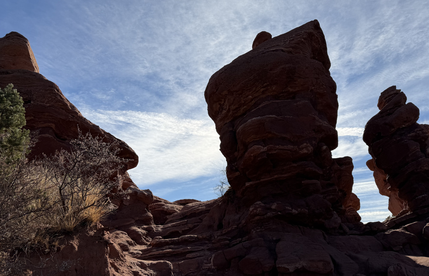
Garden of the Gods hiking trail through red rock and scrub oak
Garden hiking trail - local source photo from GardenOfTheGods, Nov 2025; resized and metadata-stripped for the site.
Red rock hiking section in Garden of the Gods
Red rock trail section - local source photo from GardenOfTheGods, Nov 2025; resized and metadata-stripped for the site.
Garden of the Gods red rock formations from the December photo set
December red rocks - local source photo from GardenOfTheGods, Dec 2025; resized and metadata-stripped for the site.
Planning Notes
  • Use the 20 AllTrails route exports below as the route picker rather than assuming one Garden of the Gods hike.
  • Perkins Central Garden Trail is the easiest central option from the saved exports: 1.1 mi, Easy, and about 25 min.
  • Arrive early or late on weekends because AllTrails notes crowds, limited parking, and limited shade on several routes.
  • Pairs well with a short scenic drive through the park.
Safety Notes
  • Stay on marked paths around fragile rock formations.
  • Expect sun exposure and bring water even for short walks.
  • Some Garden routes have rocky sections, steep spots, horse manure, or limited shade; pick the route to match the guest group.
Source Notes
  • Saved AllTrails park overview PDF in Sources checked 2026-06-13: 10 Best hikes and trails in Garden of the Gods _ AllTrails.pdf.
  • Saved 20 Garden of the Gods AllTrails route PDFs and matching route tracks in Sources checked 2026-06-13; route rows below use saved PDF facts, with route retained as route geometry source files.
  • City of Colorado Springs Garden of the Gods official page checked 2026-06-12.

Short signed Garden of the Gods trail segment

Cabin Canyon Trail from the Trading Post

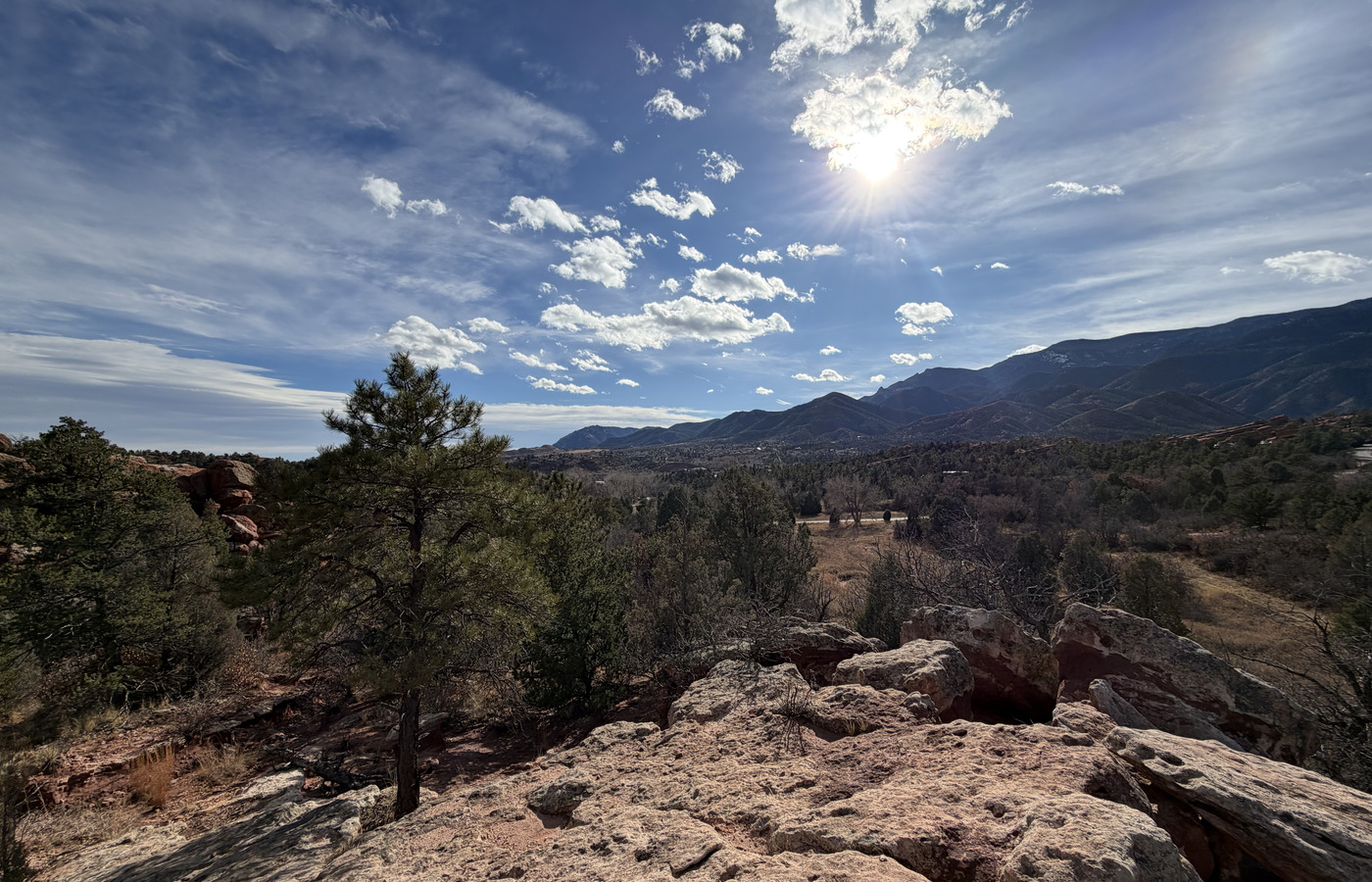
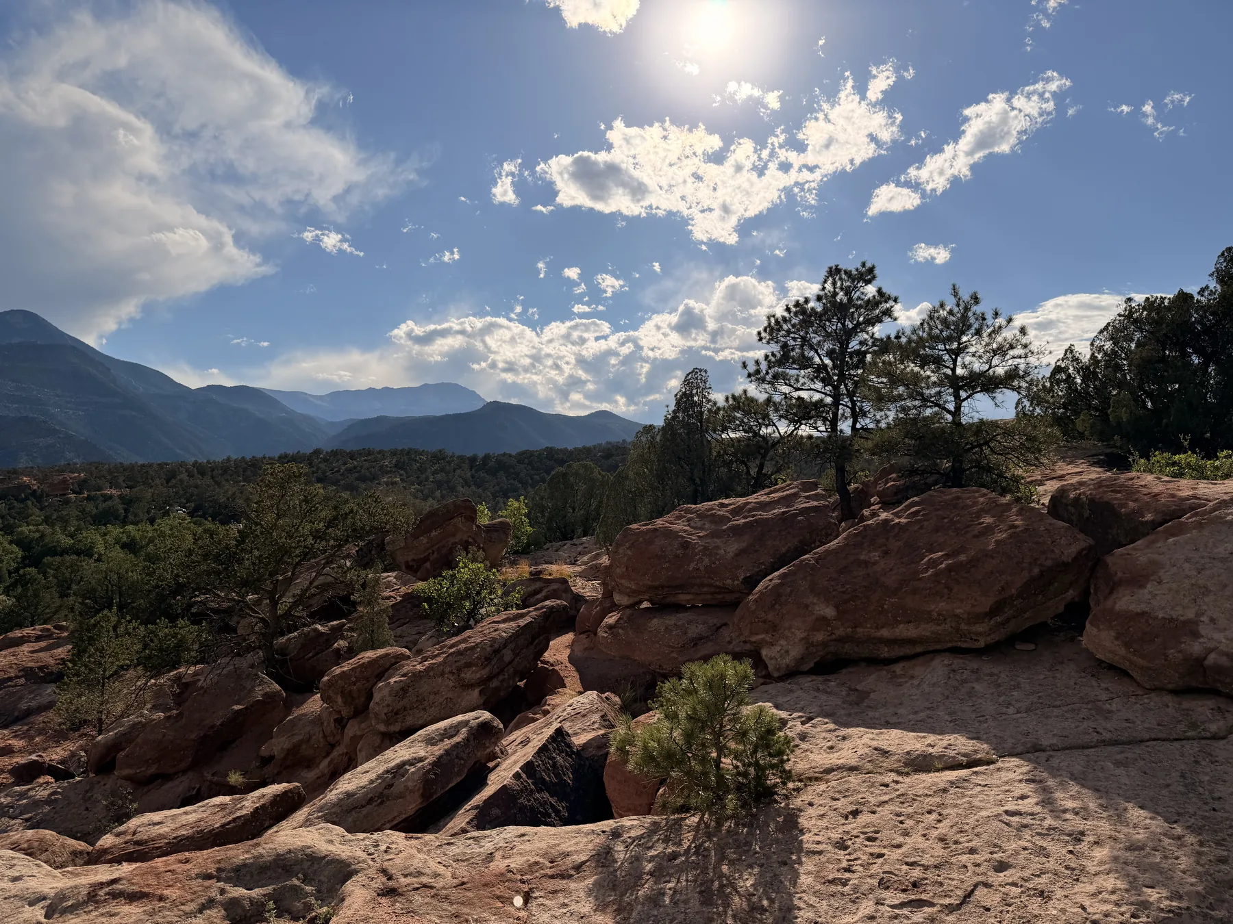
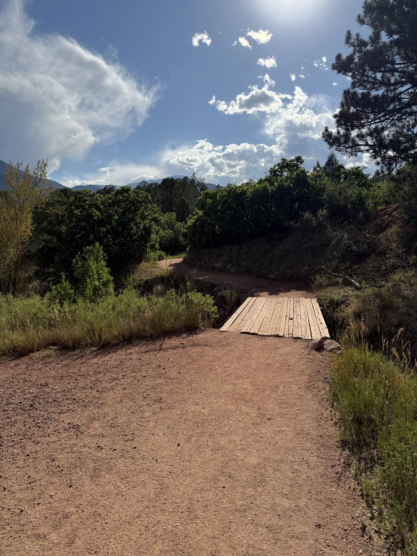
visited Cabin Canyon Trail segment near the Garden of the Gods Trading Post, with a signed dirt path, a small footbridge, red-rock overlooks, and broad mountain views.

Quick Details
Area
Garden of the Gods / Trading Post area
Location
Near the Garden of the Gods Trading Post
Last checked
2026-06-14
Difficulty
Short easy-to-moderate dirt and rock segment
Route type
visited short segment; no continuous route track
Route / Source Stats
Local visit
July 10, 2026
Photo window
17:27-17:34
Surface
Dirt path, footbridge, and exposed rock
Guest fit
Flexible add-on while visiting the Trading Post
Media
Red-rock overlook and mountain view from the Cabin Canyon Trail segment
Cabin Canyon red-rock overlook - local source photo, July 10, 2026; resized and metadata-stripped for the site.
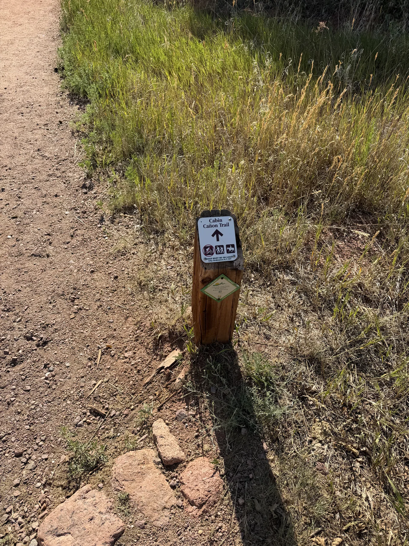
Cabin Canyon Trail marker beside the dirt path
Signed Cabin Canyon Trail - local source photo, July 10, 2026; resized and metadata-stripped for the site.
Small footbridge on the Cabin Canyon Trail near the Trading Post
Footbridge near the start of the short walk - local source photo, July 10, 2026; resized and metadata-stripped for the site.
Planning Notes
  • This works as a quick optional walk while other guests browse the Garden of the Gods Trading Post.
  • The July 10 photo sequence starts at a signed Cabin Canyon Trail marker and continues past a small bridge to red-rock and mountain overlooks.
  • Use the existing Garden of the Gods route collection for a longer planned loop; this card documents only the short segment actually walked.
Safety Notes
  • Expect uneven dirt, loose rock, exposed rock surfaces, and some sun exposure.
  • The photographed trail markers prohibit bicycles and require dogs to be on leash.
  • Turn back if nearby storms, heat, or guest timing make the exposed segment uncomfortable.
Source Notes
  • User-provided visit note received 2026-07-11: while guests and local guest visited the Trading Post, local visitor walked the nearby Cabin Canyon Trail and took photos.

National monument route collection

Florissant Fossil Beds National Monument

Source-backed planning card for Florissant Fossil Beds National Monument. Use this as a route picker for fossil, prairie, forest, creek, and Twin Rocks options; the route has not been visited yet, so the notes stay grounded in saved AllTrails sources.

Quick Details
Area
Florissant Fossil Beds National Monument
Location
Near Florissant, Colorado
Last checked
2026-06-14
Difficulty
Easy to moderate depending on selected route
Route type
Route collection: saved AllTrails trail exports and route tracks
Route / Source Stats
AllTrails routes
8 saved route entries
Planning status
Source-backed; not yet visited
Easy starter
Petrified Forest / Ponderosa or short Ponderosa Loop
Longer options
Twin Rock and Hornbek / Twin Rocks out-and-backs
Use
Walking / hiking / birding by route
Planning Notes
  • Planning card only: choose from the saved AllTrails screenshots, PDFs, and route tracks before visiting.
  • For the shortest fossil-focused walk, compare Petrified Forest Loop and Ponderosa Loop Trails with the short Florissant Ponderosa Loop.
  • For a longer outing, compare Twin Rock Trail, Hornbeck Wildlife Loop, and Hornbek Wildlife Trail and Twin Rocks Trail.
  • Most saved Florissant AllTrails trail pages say dogs aren't allowed; plan pet-free unless a current official source says otherwise.
  • Saved screenshots and PDFs also indicate a fee requirement on several routes; confirm current NPS access, fee, and closure details before leaving.
Safety Notes
  • Treat this as a planning page, not a private trip report.
  • Bring water and sun protection because several saved route notes mention open prairie, limited shade, or heat exposure.
  • Use downloaded maps or the saved route route outlines for planning, then verify current trail conditions before hiking.
Source Notes
  • Saved AllTrails screenshots in Sources checked 2026-06-14: petrified-forest-loop-and-ponderosa-loop-trails.png, sawmill-and-hans-loop.png, boulder-creek.png, hornbeck-wildlife-loop.png, florissant-loop.png, twin-rock-trail.png, and hornbek-wildlife-trail-and-twin-rocks-trail.png.
  • Saved AllTrails PDFs and route tracks in Sources checked 2026-06-14 for Petrified Forest Loop and Ponderosa Loop Trails, Sawmill and Hans Loop, Boulder Creek, Hornbeck Wildlife Loop, Florissant Loop, Florissant Ponderosa Loop, Twin Rock Trail, and Hornbek Wildlife Trail and Twin Rocks Trail.
  • Florissant Loop uses the saved AllTrails PDF for rating, review count, and difficulty; its saved screenshot supplies the visible length, elevation gain, and estimated-time row.
  • All route rows use saved source values only; missing length, elevation gain, estimated time, rating, or review fields are left blank rather than inferred.

Open-space trail network

Red Rock Canyon Open Space

Close Colorado Springs open-space hike with red-rock scenery, flexible loop lengths, and more room to spread out than Garden of the Gods.

Quick Details
Area
West Colorado Springs
Location
Red Rock Canyon Open Space
Last checked
2026-06-14
Difficulty
Easy to moderate depending on loop choice
Route type
Choose-your-own loop network
Route / Source Stats
Use
Hiking / walking
Guest fit
Flexible distance
Terrain
Open-space trails and mild grades
Planning Notes
  • Good fallback when Garden of the Gods parking is packed.
  • Pick a shorter loop for casual guests or extend into rougher side trails for more effort.
Safety Notes
  • Watch for mud after storms and ice in shaded winter sections.
  • Carry water; much of the area is exposed.
Source Notes
  • Colorado Springs Parks Red Rock Canyon Open Space public page checked 2026-06-12; direct city slugs can change.
  • Difficulty rating is local planning guidance, not an AllTrails account import.

Mesa and open-space trail network

Ute Valley Park

Neighborhood-accessible Colorado Springs trail network with short loops, mesa views, and enough terrain variety for a quick local hike.

Quick Details
Area
Northwest Colorado Springs
Location
Ute Valley Park
Last checked
2026-06-14
Difficulty
Easy to moderate; rocky in places
Route type
Loop network
Route / Source Stats
Use
Hiking / walking
Guest fit
Quick local outing
Terrain
Rocky singletrack and open-space paths
Planning Notes
  • Good short hike when guests want something close without committing to mountain driving.
  • Route choice matters; keep casual guests on shorter, lower loops.
Safety Notes
  • Footing can be uneven on rocky sections.
  • Expect shared use with bikes and runners.
Source Notes
  • Colorado Springs Parks Ute Valley Park public page checked 2026-06-12; direct city slugs can change.
  • Difficulty rating is local planning guidance, not an AllTrails account import.

Urban mesa trail network

Palmer Park

Large in-town park with mesa-top views, many short route options, and easy access from central Colorado Springs.

Quick Details
Area
Central / northeast Colorado Springs
Location
Palmer Park
Last checked
2026-06-14
Difficulty
Easy to moderate; route choice changes effort quickly
Route type
Loop network
Route / Source Stats
Use
Hiking / walking
Guest fit
Urban trail views
Terrain
Mesa trails and overlooks
Planning Notes
  • Useful for guests staying in town who want a quick hike without driving west.
  • Choose a short overlook route if time is limited.
Safety Notes
  • Stay aware of bikes and runners on shared trails.
  • Some side trails have loose gravel and exposed rock.
Source Notes
  • Colorado Springs Parks Palmer Park public page checked 2026-06-12; direct city slugs can change.
  • Difficulty rating is local planning guidance, not an AllTrails account import.

Waterfall-area foothills hike

Catamount Falls Trail

Green Mountain Falls area hike that feels more mountain-like than the in-town parks, with more grade and a better payoff for guests who want a real hike.

Quick Details
Area
Green Mountain Falls / Ute Pass
Location
Green Mountain Falls
Last checked
2026-06-14
Difficulty
Moderate; steeper than the city open-space options
Route type
Out-and-back or loop variations
Route / Source Stats
Use
Hiking
Guest fit
Better for active guests
Terrain
Foothills grade and waterfall-area route
Planning Notes
  • Good step up when guests want more than Garden of the Gods or Red Rock Canyon.
  • Check parking and access rules before leaving because Green Mountain Falls access can be limited.
Safety Notes
  • Expect steeper grades and more exertion at altitude.
  • Use traction in shoulder seasons if snow or ice is present.
Source Notes
  • Green Mountain Falls public information checked 2026-06-12; direct Catamount page timed out during verification.
  • Difficulty rating is local planning guidance, not an AllTrails account import.

Mountain trail

The Crags Trail

Popular Divide-area mountain hike with rock formations and bigger views than the city open-space options.

Quick Details
Area
Divide / Pikes Peak region
Location
Crags Campground area near Divide
Last checked
2026-06-14
Difficulty
Moderate mountain hike with altitude and weather exposure
Route type
Out-and-back
Route / Source Stats
Use
Hiking
Guest fit
Active guests / mountain payoff
Terrain
Forest, rock formations, exposed weather
Media
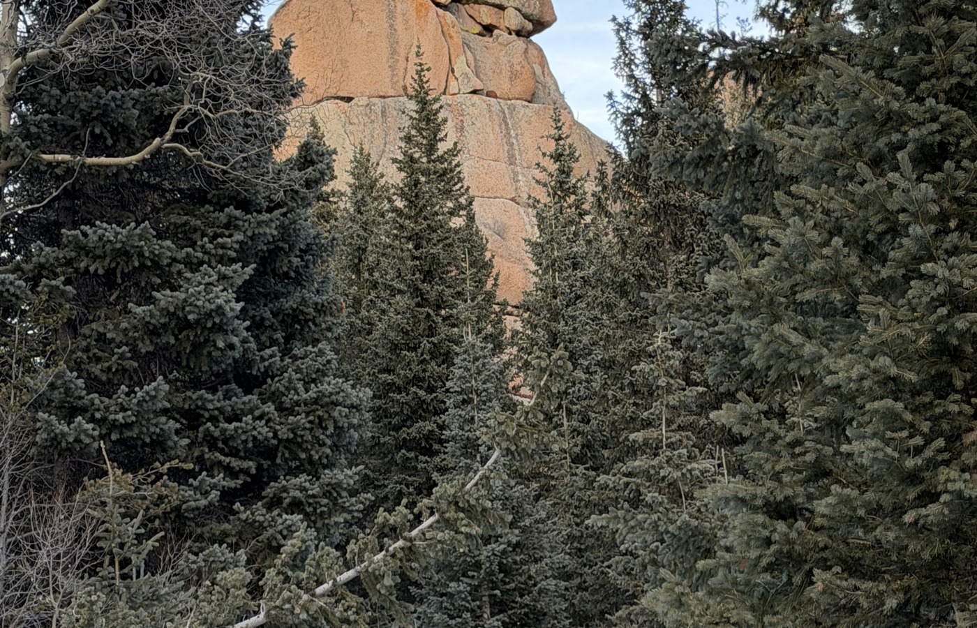
Snowy winter trail through trees on The Crags hike
Winter trail at The Crags - local source photo from Crags, Dec 2025; resized and metadata-stripped for the site.
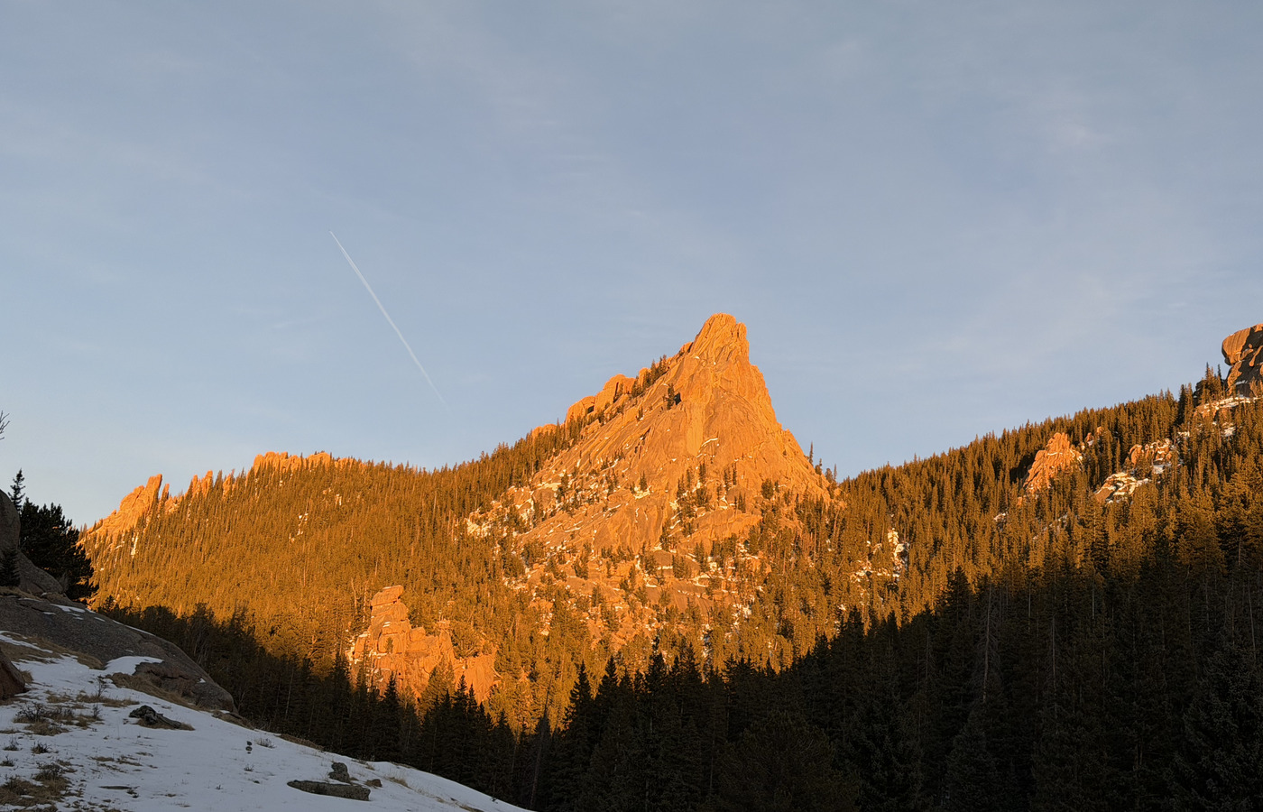
Golden light on a rock formation from The Crags area
Crags rock view - local source photo from Crags, Dec 2025; resized and metadata-stripped for the site.
Planning Notes
  • Good upgrade when guests want a real mountain hike near Woodland Park/Divide.
  • Start earlier than city hikes because weather and parking matter more.
Safety Notes
  • Check storms, wind, snow, and road access before leaving.
  • Altitude can make the effort feel harder than the mileage suggests.
Source Notes
  • USFS Pike-San Isabel National Forest recreation pages checked 2026-06-12.
  • Difficulty rating is local planning guidance, not an AllTrails account import.

Steep fitness route

Manitou Incline

Iconic Manitou Springs stair climb. It is close and memorable, but it is a workout rather than a casual hike.

Quick Details
Area
Manitou Springs
Location
Manitou Incline / Barr Trail area
Last checked
2026-06-14
Difficulty
Hard; very steep sustained climb
Route type
One-way climb with descent via Barr Trail
Route / Source Stats
Use
Fitness hike
Guest fit
Only for fit, acclimated guests
Terrain
Steep stairs and exposed effort
Planning Notes
  • Treat this as a deliberate fitness outing, not a casual guest stop.
  • Check current reservation/access rules before going.
Safety Notes
  • Altitude, heat, and the steep grade can overwhelm visitors.
  • Bring water and descend on the approved route.
Source Notes
  • Colorado Springs Parks Manitou Incline public information checked 2026-06-12.
  • Difficulty rating is local planning guidance, not an AllTrails account import.

Creek canyon trail

Seven Bridges Trail

North Cheyenne Canon hike following a creek corridor with bridge crossings and a more shaded feel.

Quick Details
Area
North Cheyenne Canon / Colorado Springs
Location
North Cheyenne Canon Park area
Last checked
2026-06-14
Difficulty
Moderate; steady grade and uneven trail
Route type
Out-and-back
Route / Source Stats
Use
Hiking
Guest fit
Classic local canyon hike
Terrain
Creek corridor, bridges, rocky sections
Planning Notes
  • Good middle option when guests want more than a stroll but not the Incline.
  • Parking and canyon traffic can be tight on nice days.
Safety Notes
  • Watch footing near bridges, rocks, and icy shaded sections.
  • Check closure/fire/weather conditions for the canyon.
Source Notes
  • Colorado Springs Parks North Cheyenne Canon public information checked 2026-06-12.
  • Difficulty rating is local planning guidance, not an AllTrails account import.

Short canyon overlook hike

Mount Cutler Trail

Short North Cheyenne Canon overlook hike with a strong scenery-to-effort ratio for guests.

Quick Details
Area
North Cheyenne Canon / Colorado Springs
Location
North Cheyenne Canon Park area
Last checked
2026-06-14
Difficulty
Easy to moderate; short but with grade and exposure
Route type
Out-and-back
Route / Source Stats
Use
Hiking
Guest fit
Short scenic payoff
Terrain
Canyon trail and overlook
Planning Notes
  • Good when guests want a real overlook without a long hike.
  • Pairs well with a North Cheyenne Canon scenic drive.
Safety Notes
  • Use caution near edges and on loose gravel.
  • Avoid icy conditions if guests are not comfortable with exposure.
Source Notes
  • Colorado Springs Parks North Cheyenne Canon public information checked 2026-06-12.
  • Difficulty rating is local planning guidance, not an AllTrails account import.

Easy interpretive trail network

Paint Mines Interpretive Park

Colorful prairie hoodoo and clay formation area east of Colorado Springs; easy walking and very guest-friendly.

Quick Details
Area
Calhan / eastern El Paso County
Location
Paint Mines Interpretive Park
Last checked
2026-06-14
Difficulty
Easy walking; exposed to sun and wind
Route type
Short interpretive loops
Route / Source Stats
Use
Walking / hiking
Guest fit
Easy geology stop
Terrain
Prairie paths and interpretive area
Planning Notes
  • Different scenery from the foothills and good for guests who like geology/photos.
  • Plan for the drive east from Colorado Springs.
Safety Notes
  • Stay out of closed restoration areas and off fragile formations.
  • Bring sun protection because shade is limited.
Source Notes
  • El Paso County Paint Mines Interpretive Park public page checked 2026-06-12.
  • Difficulty rating is local planning guidance, not an AllTrails account import.

State park trail network

Mueller State Park

Nearby Divide-area state park with forested trails, wildlife viewing, and flexible route lengths for guests.

Quick Details
Area
Divide / Teller County
Location
Mueller State Park
Last checked
2026-06-14
Difficulty
Easy to moderate depending on selected trail
Route type
State park trail network
Route / Source Stats
Use
Hiking
Guest fit
Flexible forested outing
Terrain
State park trails, forest, overlooks
Planning Notes
  • Good Woodland Park/Divide-area option when guests want nature without a rough trailhead.
  • Pick trail length based on guest energy and weather.
Safety Notes
  • State park pass or day fee may apply.
  • Check seasonal trail conditions before longer loops.
Source Notes
  • Colorado Parks and Wildlife Mueller State Park public page checked 2026-06-12.
  • Difficulty rating is local planning guidance, not an AllTrails account import.

Driving / Off-Road

Historic dirt shelf road and scenic byway segment

Shelf Road

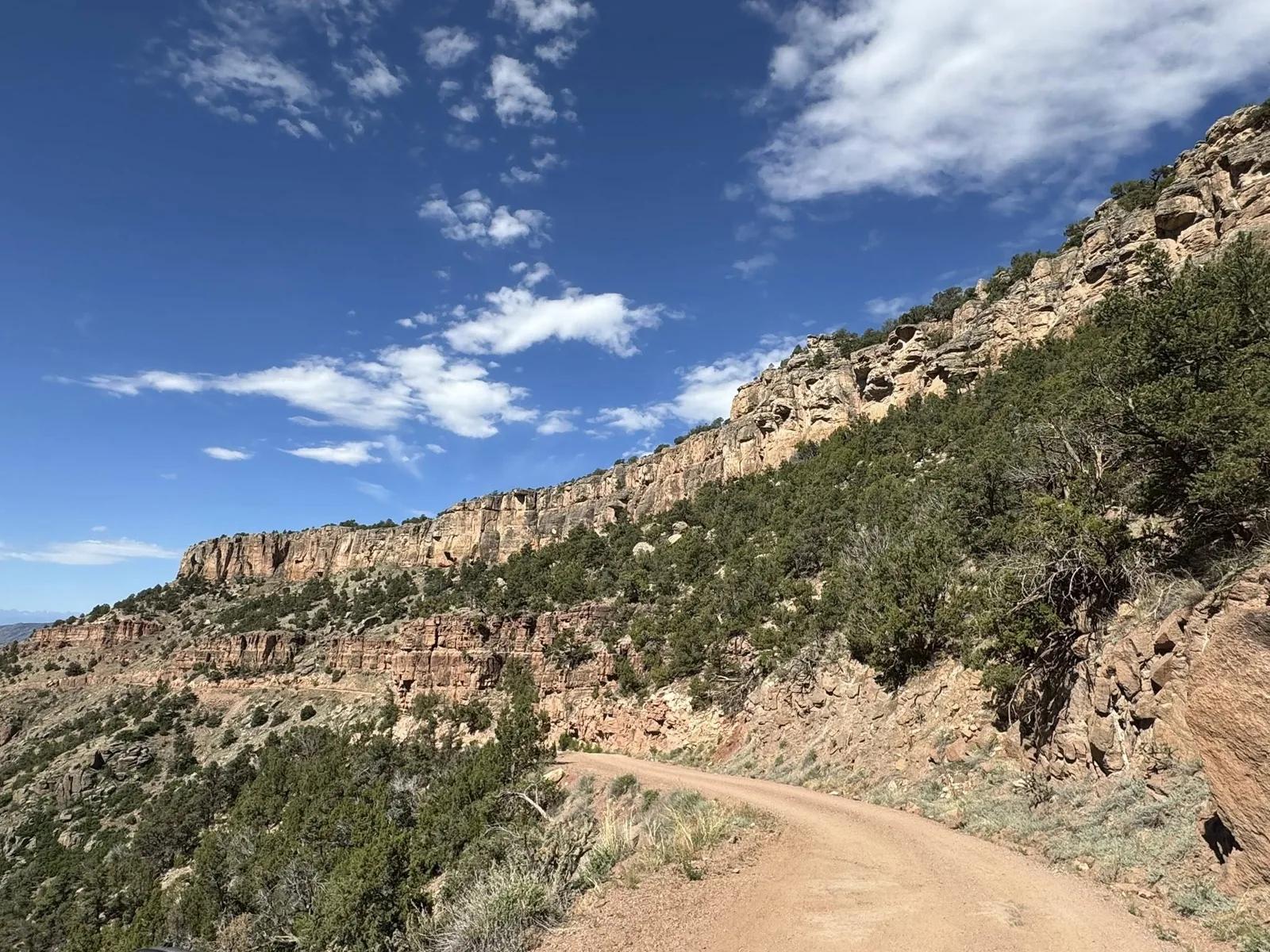
Historic dirt road north of Canon City that follows the old stagecoach route toward Cripple Creek, with canyon walls, limestone bands, and exposed shelf-road driving.

Quick Details
Area
Gold Belt Tour / Canon City to Cripple Creek
Location
North of Canon City along Fourmile Creek
Last checked
2026-06-14
Difficulty
Easy to moderate dirt road with shelf exposure; weather-dependent
Route type
Point-to-point scenic dirt road
Route / Source Stats
Surface
Dirt road
Elevation
5,330 ft at Canon City to 9,395 ft at Cripple Creek
Primary source
BLM Shelf Road Sites
Media
Shelf Road canyon wall and dirt-road shelf view
Shelf Road canyon wall and dirt-road shelf view - Source photo; resized and metadata-stripped for the site.
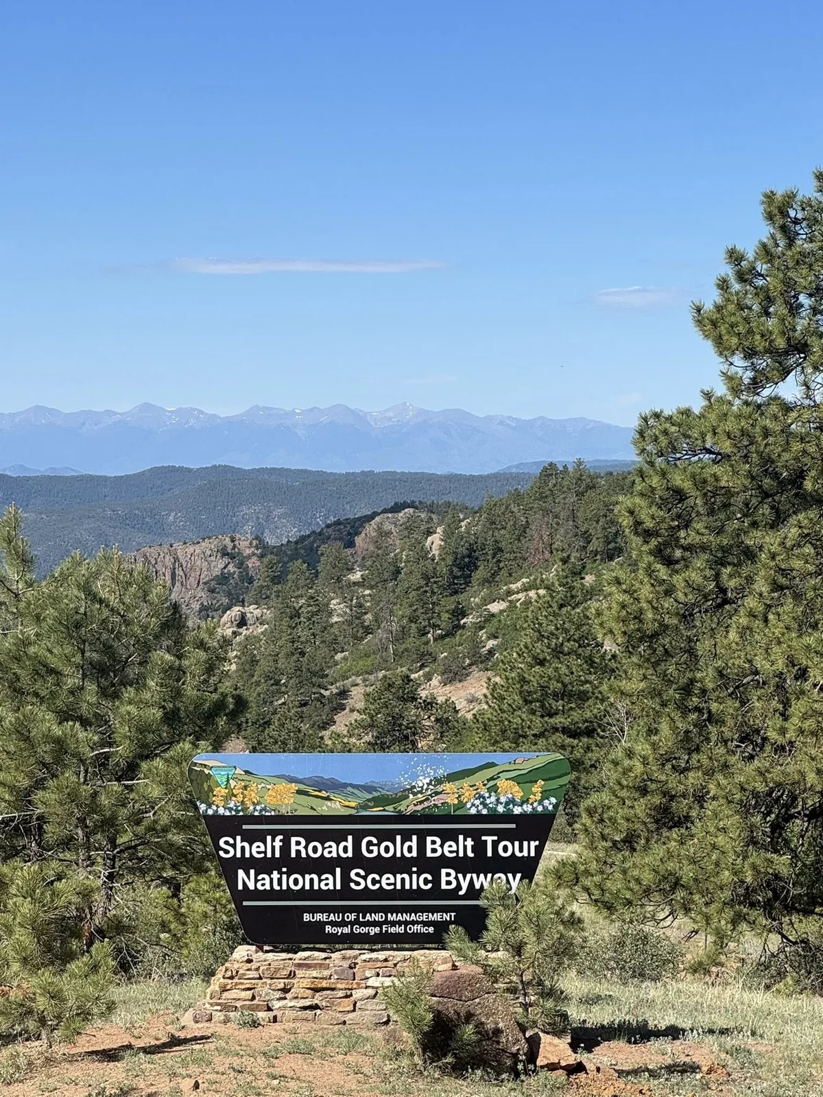
Shelf Road Gold Belt Tour sign
Shelf Road Gold Belt Tour sign - Source photo; resized and metadata-stripped for the site.
Planning Notes
  • BLM describes Shelf Road as north of Canon City and following the old stagecoach route to Cripple Creek.
  • BLM notes Canon City built the toll road in 1892 and that it is free now.
  • Expect a dirt road through valleys and canyons along Fourmile Creek.
  • No restrooms are listed along Shelf Road; plan stops before and after the drive.
  • No water sources are listed along Shelf Road; bring your own water and plan for 1-2 hours of drive time.
  • For two people in warm or dry weather, carry at least 1 gallon of water for the Shelf Road segment.
  • The guest trip map continues through Phantom Canyon and ends at Rita the Rock Planter near Victor.
Safety Notes
  • Shelf exposure can be uncomfortable for passengers or drivers who dislike drop-offs.
  • Avoid the route in poor weather, snow, ice, or heavy rain unless current conditions support it.
  • BLM directions note trailers are not advised on the Banks road.
  • Do not count on services along the route; keep water, layers, and basic supplies in the vehicle.
Vehicle Fit

Best fit: AWD or 4WD vehicle with high clearance (9 in); low-clearance or 2WD vehicles are not recommended

  • Good match in dry open conditions: the 4xe Backcountry setup and larger tires provide more confidence than a stock Wrangler on dirt, washboard, and mild rocky sections.
  • Use the extra capability as margin, not permission to rush; shelf exposure still calls for slow speeds and careful line choice.

2025 Jeep Wrangler 4xe Backcountry
High-clearance off-road vehicle used as the primary Jeep route baseline.

2014 Chrysler 300 C
Guest-use road car for paved scenic drives and normal roads in good weather.

Ford Ranger Lariat FX4
Ford Ranger Lariat FX4 pickup reference vehicle for route width, clearance, and turn-radius comparison.

Kawasaki Brute Force 750 4x4i ATV
ATV reference vehicle for ATV-legal routes where current permission and conditions fit.

Source Notes
  • BLM Shelf Road Sites official page checked 2026-06-12: north of Canon City, old stagecoach route to Cripple Creek, dirt road, elevation change, and Banks-road trailer warning.
  • DuckDuckGo result snippet checked 2026-06-12 for Gold Belt/Shelf Road context; excluded COTREX Shelf Road page because it resolved to a different Colorado road.
  • Route feedback received 2026-08-07: no restrooms or water sources along Shelf Road; plan accordingly and bring about 1 gallon of water for two people.
  • Source photos added 2026-06-14 for the Shelf Road / Gold Belt Tour thread; site copies are resized and metadata-stripped.

Paved park road

Garden of the Gods Scenic Drive

Guest-friendly paved scenic drive through Garden of the Gods. It is not off-road, but it belongs on the driving list because it is close, easy, and memorable.

Quick Details
Area
Garden of the Gods / Colorado Springs
Location
Garden of the Gods Park, west Colorado Springs
Last checked
2026-06-14
Difficulty
Very easy paved park driving; traffic and parking are the main constraints
Route type
Paved scenic loop/park roads
Route / Source Stats
Surface
Paved
Vehicle need
Any passenger vehicle
Guest fit
Best quick scenic drive
Media
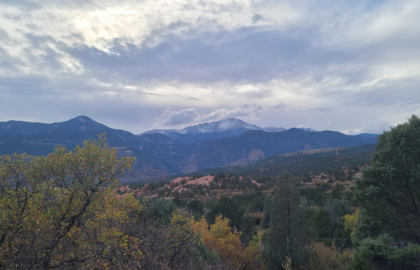
Garden of the Gods scenic drive overlook with mountain views
Driving overlook - local source photo from GardenOfTheGods, Oct 2024; resized and metadata-stripped for the site.
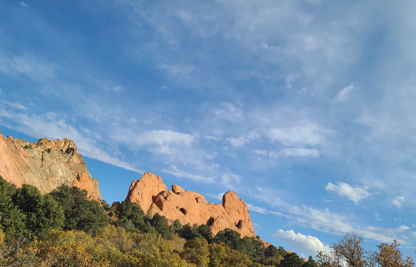
Garden of the Gods red rocks from the scenic drive
Red rocks from the drive - local source photo from GardenOfTheGods, Oct 2024; resized and metadata-stripped for the site.
Planning Notes
  • Use this for guests who want scenery without dirt roads or hiking commitment.
  • Pair with the Central Garden Trail for an easy half-day outing.
Safety Notes
  • Watch for pedestrians, cyclists, buses, and crowded pullouts.
  • Do not treat this as an off-road trail; stay on paved public roads.
Vehicle Fit

2014 Chrysler 300 C is appropriate in good weather; Jeep Backcountry is the comfortable margin vehicle

  • Use the 300 C for normal guest road drives in good weather; use the Jeep when weather, road surface, or shoulder/parking conditions need extra margin.
  • This is intentionally listed as an easy scenic drive rather than a Jeep-capability route.

2025 Jeep Wrangler 4xe Backcountry
High-clearance off-road vehicle used as the primary Jeep route baseline.

2014 Chrysler 300 C
Guest-use road car for paved scenic drives and normal roads in good weather.

Ford Ranger Lariat FX4
Ford Ranger Lariat FX4 pickup reference vehicle for route width, clearance, and turn-radius comparison.

Kawasaki Brute Force 750 4x4i ATV
ATV reference vehicle for ATV-legal routes where current permission and conditions fit.

Source Notes
  • City of Colorado Springs Garden of the Gods official page checked 2026-06-12.
  • Difficulty rating is local planning guidance.

Paved canyon road

North Cheyenne Canon Scenic Drive

Paved scenic canyon drive that pairs naturally with Mount Cutler, Helen Hunt Falls, and other North Cheyenne Canon stops. It belongs here for guest planning even though it is not off-road.

Quick Details
Area
North Cheyenne Canon / Colorado Springs
Location
North Cheyenne Canon Park
Last checked
2026-06-14
Difficulty
Very easy paved canyon driving; narrow park traffic and parking are the main constraints
Route type
Paved canyon scenic drive
Route / Source Stats
Surface
Paved
Vehicle need
Any passenger vehicle
Guest fit
Easy canyon scenery and trail pairing
Planning Notes
  • Pair this with Mount Cutler Trail for a short scenic outing.
  • Also works as a low-effort guest drive when a hike is not the main goal.
  • Parking can be tight around popular trailheads and waterfall stops.
Safety Notes
  • Watch for pedestrians, cyclists, narrow pullouts, and slow park traffic.
  • Do not treat this as an off-road trail; stay on paved public roads and marked parking areas.
Vehicle Fit

2014 Chrysler 300 C is appropriate in good weather; Jeep Backcountry is the comfortable margin vehicle

  • Use the 300 C for normal guest road drives in good weather; use the Jeep when weather, road surface, or shoulder/parking conditions need extra margin.
  • Listed for guest planning and scenery, not because Jeep capability is required.

2025 Jeep Wrangler 4xe Backcountry
High-clearance off-road vehicle used as the primary Jeep route baseline.

2014 Chrysler 300 C
Guest-use road car for paved scenic drives and normal roads in good weather.

Ford Ranger Lariat FX4
Ford Ranger Lariat FX4 pickup reference vehicle for route width, clearance, and turn-radius comparison.

Kawasaki Brute Force 750 4x4i ATV
ATV reference vehicle for ATV-legal routes where current permission and conditions fit.

Source Notes
  • Colorado Springs Parks North Cheyenne Canon public information checked 2026-06-12.
  • Difficulty rating is local planning guidance.

Paved mountain highway

Highway 67 to Cripple Creek

Paved drive from the Woodland Park/Divide side down CO-67 toward Cripple Creek. This is a guest-friendly scenic route, especially in fall when the aspens and leaves are changing color.

Quick Details
Area
Woodland Park / Divide to Cripple Creek
Location
CO-67 between the Ute Pass area and Cripple Creek
Last checked
2026-06-14
Difficulty
Very easy paved mountain driving; watch curves, weather, wildlife, and tourist traffic
Route type
Paved point-to-point scenic drive
Route / Source Stats
Surface
Paved highway
Best season
Fall color
Vehicle need
Any passenger vehicle
Media
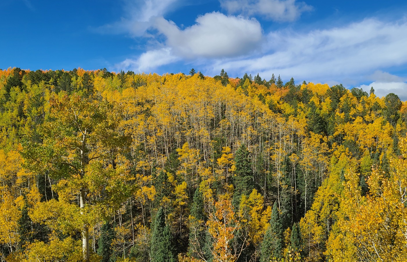
Fall aspen color along the Highway 67 drive toward Cripple Creek
Fall color along CO-67 - local source photo from CrippleCreek67, 2025-09-28; resized and metadata-stripped for the site.
Wide mountain view from the Rita the Troll stop near the Highway 67 drive
View from the Rita the Troll stop - local source photo from CrippleCreek67/rita.jpg, 2025-09-28; resized and metadata-stripped for the site.
Planning Notes
  • Especially beautiful in fall when the aspens and leaves are changing color.
  • Good guest drive when you want mountain scenery without dirt-road commitment.
  • Rita the Troll is a worthwhile short side stop from 67; the view from up there is worth the small detour.
  • Pair with a Cripple Creek stop for food, a walk, or a longer Gold Belt day.
Safety Notes
  • Watch for wildlife, winter weather, ice, curves, motorcycles, and slower tourist traffic.
  • This is not an off-road trail; stay on paved public roads and marked pullouts.
  • Check weather before taking guests because the route gains elevation and can change quickly.
Vehicle Fit

2014 Chrysler 300 C is appropriate in good weather; Jeep Backcountry is the comfortable margin vehicle

  • Use the 300 C for normal guest road drives in good weather; use the Jeep when weather, road surface, or shoulder/parking conditions need extra margin.
  • Listed for guest planning and fall scenery, not because Jeep capability is required.

2025 Jeep Wrangler 4xe Backcountry
High-clearance off-road vehicle used as the primary Jeep route baseline.

2014 Chrysler 300 C
Guest-use road car for paved scenic drives and normal roads in good weather.

Ford Ranger Lariat FX4
Ford Ranger Lariat FX4 pickup reference vehicle for route width, clearance, and turn-radius comparison.

Kawasaki Brute Force 750 4x4i ATV
ATV reference vehicle for ATV-legal routes where current permission and conditions fit.

Source Notes
  • User-provided route note checked 2026-06-12: drive from here to Cripple Creek on 67, especially beautiful in fall when leaves are changing colors.
  • User-provided Rita the Troll note checked 2026-06-12: the view from up there is worth the short drive from 67.
  • Difficulty rating is local planning guidance.

Long paved mountain drive

Drive to Ouray

Long scenic drive out to Ouray with mountain views, creek stops, and a strong payoff once you reach the San Juan scenery. Treat it as a beautiful trip drive rather than a quick local outing.

Quick Details
Area
Colorado Springs / Woodland Park to Ouray
Location
Paved highway route west and southwest to Ouray, Colorado
Last checked
2026-06-14
Difficulty
Easy to moderate paved mountain driving; long distance, weather, altitude, and daylight matter
Route type
Long paved scenic drive / trip route
Route / Source Stats
Surface
Paved highways
Guest fit
Best as a day trip with an early start or overnight
Primary concern
Weather, daylight, and mountain passes
Media
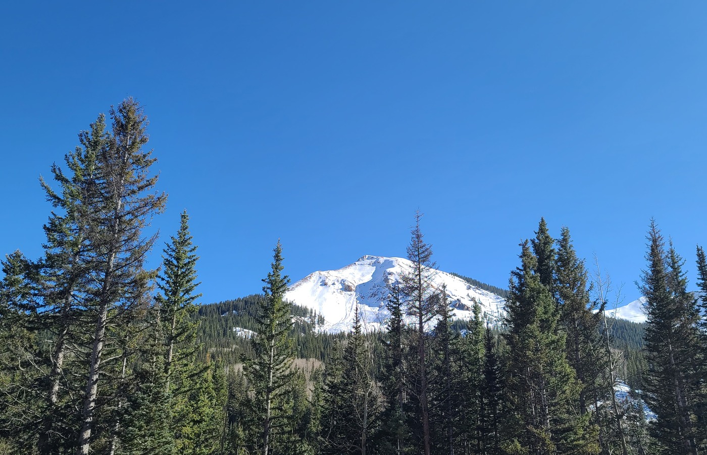
Snowy mountain view from the drive to Ouray
Mountain drive scenery - local source photo from Ouray, Oct 2024; resized and metadata-stripped for the site.
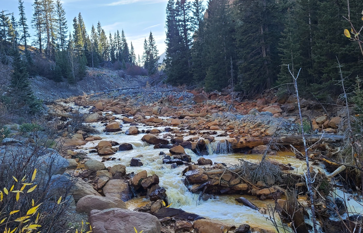
Creek and forest view from the Ouray trip
Creek stop on the Ouray trip - local source photo from Ouray, Oct 2024; resized and metadata-stripped for the site.
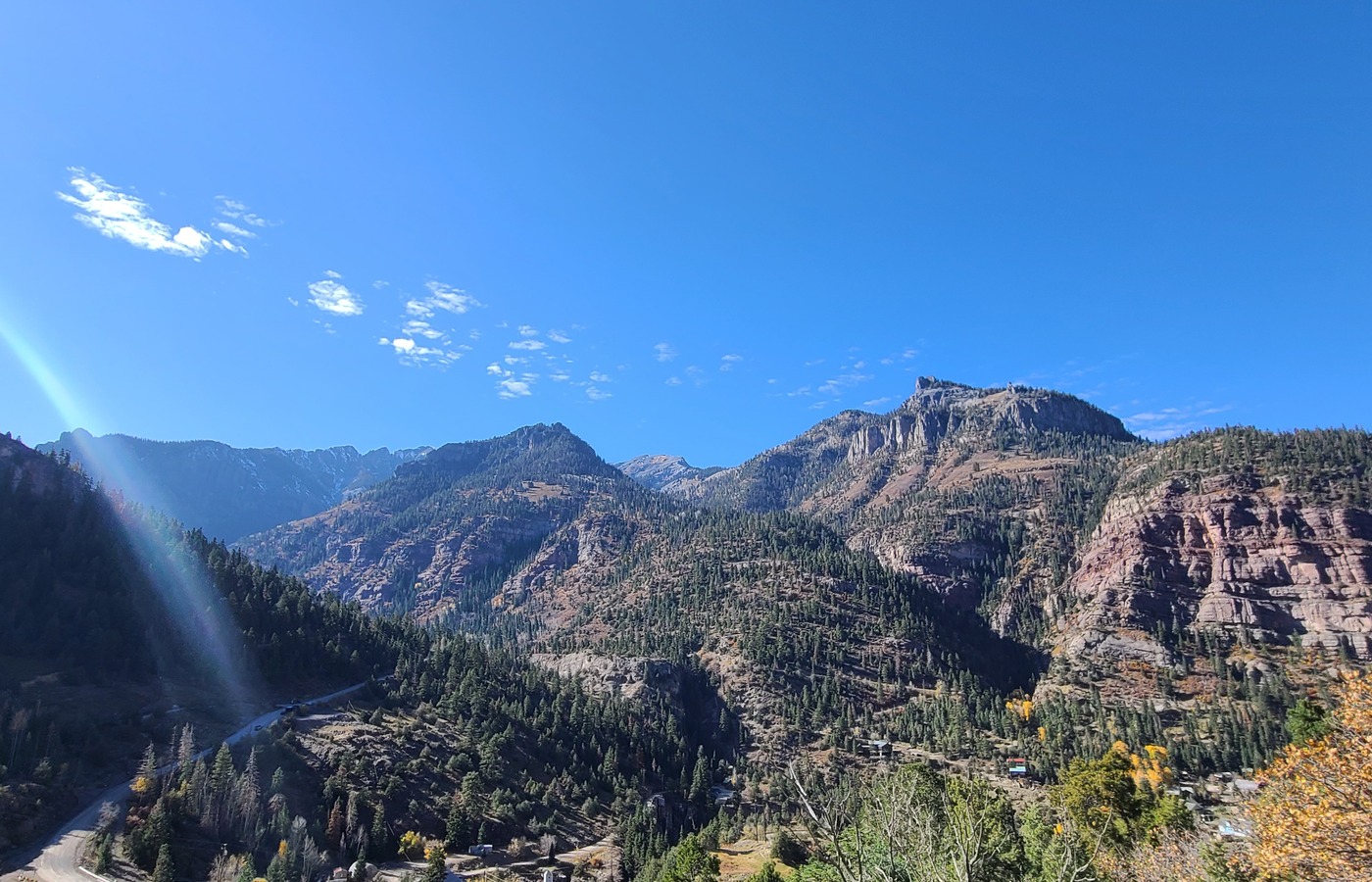
Ouray mountain overlook and valley view
Ouray overlook - local source photo from Ouray, Oct 2024; resized and metadata-stripped for the site.
Planning Notes
  • Beautiful drive with a big scenery payoff; better when you can make time for stops instead of rushing.
  • Use the household Ouray photos as a reminder that the destination and the road out are both part of the trip.
  • Check weather, pass conditions, and daylight before committing, especially outside summer.
Safety Notes
  • Do not treat this like a quick local drive; fatigue and changing mountain weather are the main risks.
  • Watch for winter conditions, rockfall areas, wildlife, curves, and slow traffic.
  • Carry layers, water, offline maps, and enough fuel/charge margin for a long mountain route.
Vehicle Fit

2014 Chrysler 300 C is appropriate in good weather; Jeep Backcountry is the comfortable margin vehicle

  • Use the 300 C for normal guest road drives in good weather; use the Jeep when weather, road surface, or shoulder/parking conditions need extra margin.
  • The 2025 Jeep Wrangler 4xe Backcountry is comfortable for this trip, but the route is listed for scenery and planning rather than off-road capability.

2025 Jeep Wrangler 4xe Backcountry
High-clearance off-road vehicle used as the primary Jeep route baseline.

2014 Chrysler 300 C
Guest-use road car for paved scenic drives and normal roads in good weather.

Ford Ranger Lariat FX4
Ford Ranger Lariat FX4 pickup reference vehicle for route width, clearance, and turn-radius comparison.

Kawasaki Brute Force 750 4x4i ATV
ATV reference vehicle for ATV-legal routes where current permission and conditions fit.

Source Notes
  • User-provided route note checked 2026-06-12: add the drive out to Ouray because it is beautiful.
  • Visit Ouray public tourism page linked for destination planning.
  • Difficulty rating is local planning guidance.

Long paved mountain drive

Drive to Estes Park

Long scenic drive to Estes Park and the Rocky Mountain National Park gateway, with mountain overlooks, high-country weather, and enough distance to treat it as a full trip.

Quick Details
Area
Colorado Springs / Woodland Park to Estes Park
Location
Paved highway route north to Estes Park, Colorado
Last checked
2026-06-14
Difficulty
Easy to moderate paved mountain driving; long distance, traffic, weather, and park access matter
Route type
Long paved scenic drive / trip route
Route / Source Stats
Surface
Paved highways
Guest fit
Full-day drive or overnight
Primary concern
Traffic, weather, park reservations
Media
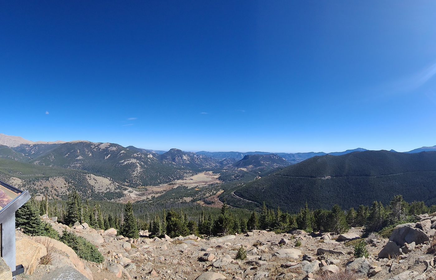
Mountain panorama from the Estes Park trip
Estes Park mountain view - local source photo from EstesPark, Oct 2025; resized and metadata-stripped for the site.
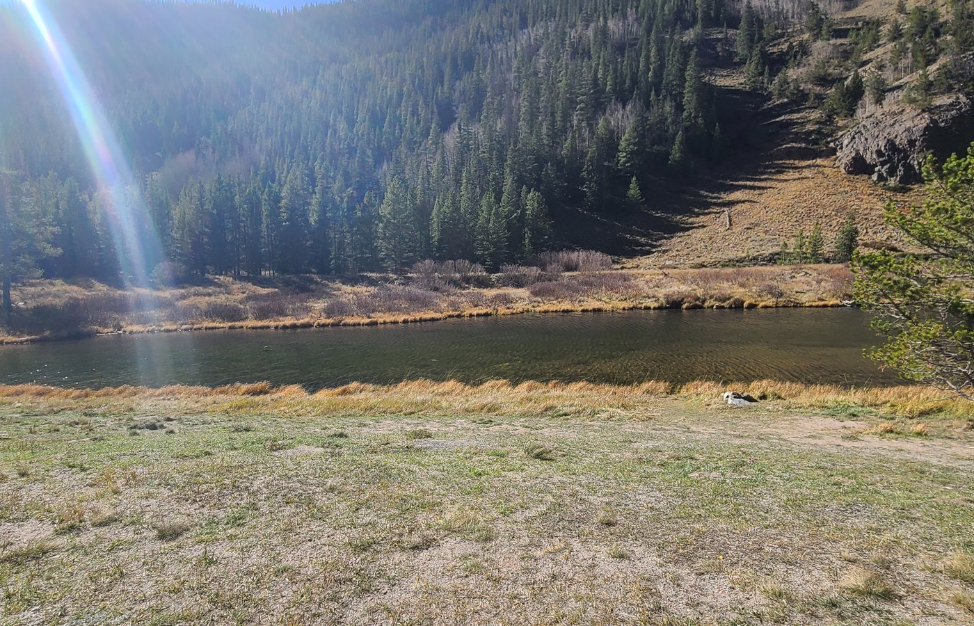
Mountain lake view from the drive toward Estes Park
Route lake view - local source photo from EstesPark, Oct 2025; resized and metadata-stripped for the site.
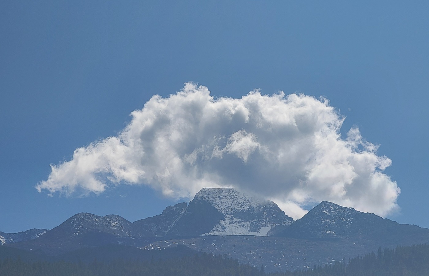
Cloud over a mountain peak near Estes Park
Cloud over the peaks - local source photo from EstesPark, Oct 2025; resized and metadata-stripped for the site.
Planning Notes
  • Good driving tab for guests who want a bigger Colorado mountain day than the local loops.
  • Pairs naturally with Rocky Mountain National Park planning if time, reservations, and weather line up.
  • Use the household EstesPark photos as a reminder to leave time for overlooks and stops, not just the destination.
Safety Notes
  • Check Rocky Mountain National Park access rules, timed-entry requirements, and weather before leaving.
  • Expect tourist traffic, wildlife, altitude, and fast-changing mountain conditions.
  • Carry layers, water, offline maps, and enough fuel/charge margin for a long drive.
Vehicle Fit

2014 Chrysler 300 C is appropriate in good weather; Jeep Backcountry is the comfortable margin vehicle

  • Use the 300 C for normal guest road drives in good weather; use the Jeep when weather, road surface, or shoulder/parking conditions need extra margin.
  • The 2025 Jeep Wrangler 4xe Backcountry is comfortable for the trip, but this is a scenic driving card rather than an off-road route.

2025 Jeep Wrangler 4xe Backcountry
High-clearance off-road vehicle used as the primary Jeep route baseline.

2014 Chrysler 300 C
Guest-use road car for paved scenic drives and normal roads in good weather.

Ford Ranger Lariat FX4
Ford Ranger Lariat FX4 pickup reference vehicle for route width, clearance, and turn-radius comparison.

Kawasaki Brute Force 750 4x4i ATV
ATV reference vehicle for ATV-legal routes where current permission and conditions fit.

Source Notes
  • Visit Estes Park public tourism page linked for destination planning.
  • Difficulty rating is local planning guidance.

Forest road / scenic dirt route

Rampart Range Road

Long Rampart Range forest-road option west of Colorado Springs and Woodland Park, useful for an easy dirt-road outing with views and many bail-out choices.

Quick Details
Area
Rampart Range / Pike National Forest
Location
Between the Colorado Springs foothills and Woodland Park area
Last checked
2026-06-14
Difficulty
Easy dirt road in dry conditions; conditions vary by season
Route type
Point-to-point or out-and-back forest road
Route / Source Stats
Surface
Dirt forest road
Vehicle fit
Good Backcountry warm-up
Primary concern
Weather, washboard, closures
Media
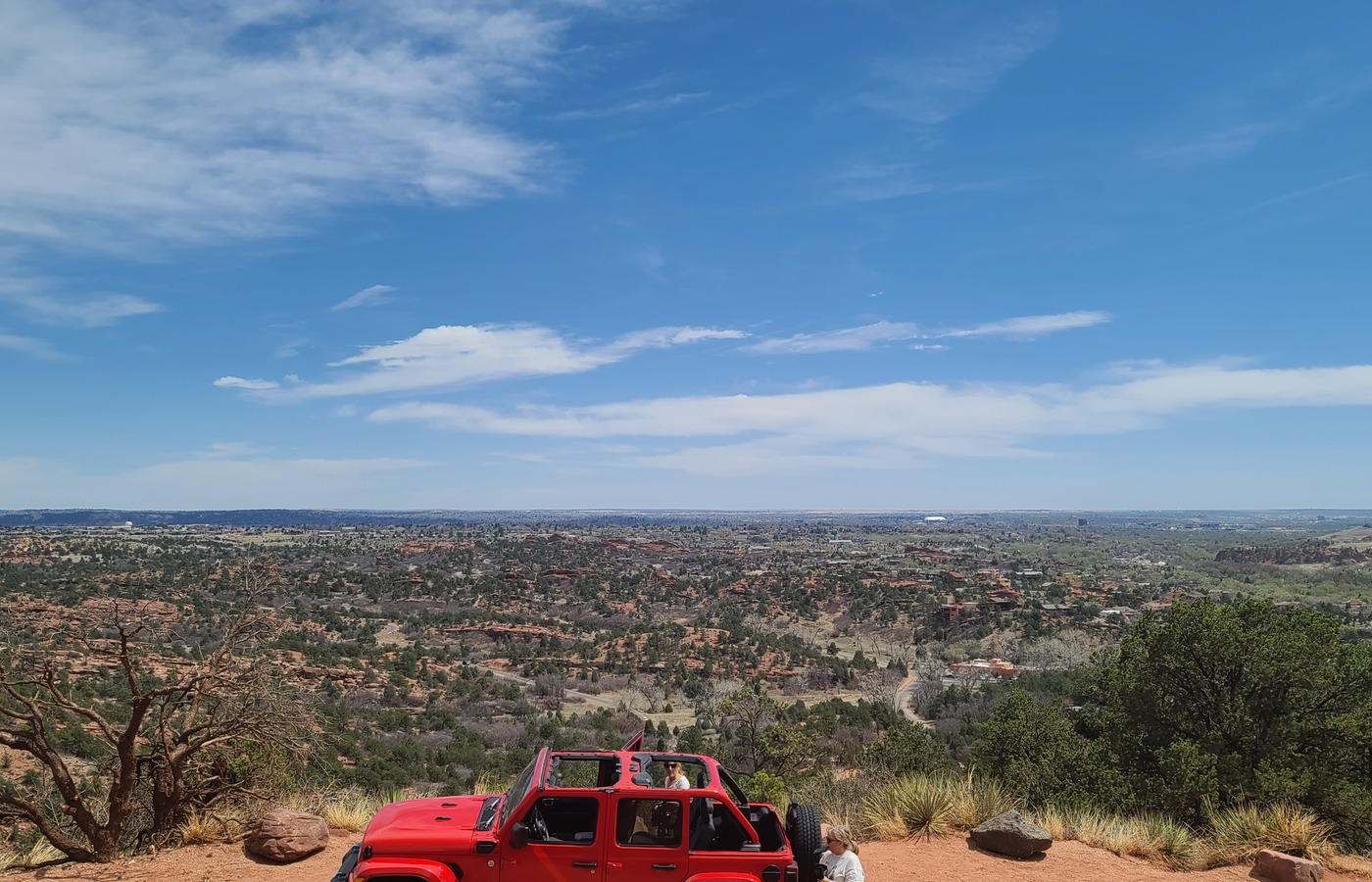
Rampart Range Road overlook with the Jeep and Front Range views
Rampart Range overlook - local source photo from RampartRangeRd, Apr 2025; resized and metadata-stripped for the site.
Furthest point reached on the Rampart Range Road April drive
Furthest point from the April Rampart drive - local source photo from RampartRangeRd/20250412_133252.jpg, Apr 2025; resized and metadata-stripped for the site.
Planning Notes
  • Good first dirt-road choice for guests because it is close and can be shortened.
  • Check seasonal closures and road condition before committing to a long route.
Safety Notes
  • Avoid when muddy, snowy, icy, or during active fire restrictions/closures.
  • Watch for mixed use, dust, blind curves, and washboard.
Vehicle Fit

Best fit: AWD or 4WD vehicle with high clearance (9 in); low-clearance or 2WD vehicles are not recommended

  • A good match for the Backcountry setup in dry open conditions; larger tires help with washboard and mild ruts.

2025 Jeep Wrangler 4xe Backcountry
High-clearance off-road vehicle used as the primary Jeep route baseline.

2014 Chrysler 300 C
Guest-use road car for paved scenic drives and normal roads in good weather.

Ford Ranger Lariat FX4
Ford Ranger Lariat FX4 pickup reference vehicle for route width, clearance, and turn-radius comparison.

Kawasaki Brute Force 750 4x4i ATV
ATV reference vehicle for ATV-legal routes where current permission and conditions fit.

Source Notes
  • USFS Pike-San Isabel National Forest recreation pages checked 2026-06-12.
  • Difficulty rating is local planning guidance.

Historic Gold Belt byway road

Phantom Canyon Road

Scenic dirt-road byway segment connecting the Canon City/Florence side toward Victor/Cripple Creek, with tunnels, narrow sections, and historic mining-country views.

Quick Details
Area
Gold Belt Tour / Victor and Canon City region
Location
Between Florence/Canon City area and Victor
Last checked
2026-06-14
Difficulty
Easy to moderate scenic dirt road; narrow sections and weather matter
Route type
Point-to-point scenic dirt road
Route / Source Stats
Surface
Dirt/gravel scenic byway
Vehicle fit
Comfortable Backcountry day trip
Primary concern
Narrow road, weather, traffic
Planning Notes
  • Best treated as a scenic byway day trip, not a technical trail.
  • Works well as a loop idea with other Gold Belt roads if conditions are good.
  • A user-reported vault-style outhouse is available along Phantom Canyon Road; no running water is available, so still plan water and stops conservatively.
  • No water sources are listed along Phantom Canyon Road; bring your own water and plan for 1-2 hours of drive time.
  • For two people in warm or dry weather, carry at least 1 gallon of water for the Phantom Canyon segment.
  • The guest trip map starts with Shelf Road, continues through Phantom Canyon, and ends at Rita the Rock Planter near Victor.
Safety Notes
  • Use care on narrow sections and around blind corners.
  • Avoid poor weather, ice, or heavy rain.
  • Do not count on services along the route; keep water, layers, and basic supplies in the vehicle.
Vehicle Fit

Best fit: AWD or 4WD vehicle with high clearance (9 in); low-clearance or 2WD vehicles are not recommended

  • More vehicle than required in good conditions, which makes it a comfortable scenic dirt-road option.

2025 Jeep Wrangler 4xe Backcountry
High-clearance off-road vehicle used as the primary Jeep route baseline.

2014 Chrysler 300 C
Guest-use road car for paved scenic drives and normal roads in good weather.

Ford Ranger Lariat FX4
Ford Ranger Lariat FX4 pickup reference vehicle for route width, clearance, and turn-radius comparison.

Kawasaki Brute Force 750 4x4i ATV
ATV reference vehicle for ATV-legal routes where current permission and conditions fit.

Source Notes
  • Gold Belt Tour Scenic and Historic Byway public information checked 2026-06-12; direct subpage slugs can change.
  • Difficulty rating is local planning guidance.
  • Guest trip map updated 2026-07-11: Shelf Road, Phantom Canyon, then Rita the Rock Planter.

Foothills connector and historic road corridor

Gold Camp Road / Old Stage Road

Close Colorado Springs foothills driving option with dirt-road sections, views, and an easy route feel when conditions are dry and open.

Quick Details
Area
Southwest Colorado Springs foothills
Location
Old Stage Road and Gold Camp Road corridor
Last checked
2026-06-14
Difficulty
Easy to moderate; dirt sections, washboard, and closures can change the feel
Route type
Out-and-back or connector drive
Route / Source Stats
Surface
Paved and dirt road sections
Vehicle fit
Easy Backcountry local drive
Primary concern
Closures and road surface
Planning Notes
  • Useful as a nearby scenic drive when there is not time for Shelf Road or Phantom Canyon.
  • Check current closures because access and road segments can change.
Safety Notes
  • Slow down for washboard, cyclists, hikers, and narrow stretches.
  • Avoid icy or muddy conditions.
Vehicle Fit

Best fit: AWD or 4WD vehicle with high clearance (9 in); low-clearance or 2WD vehicles are not recommended

  • A relaxed local route for the Backcountry setup when conditions are dry.

2025 Jeep Wrangler 4xe Backcountry
High-clearance off-road vehicle used as the primary Jeep route baseline.

2014 Chrysler 300 C
Guest-use road car for paved scenic drives and normal roads in good weather.

Ford Ranger Lariat FX4
Ford Ranger Lariat FX4 pickup reference vehicle for route width, clearance, and turn-radius comparison.

Kawasaki Brute Force 750 4x4i ATV
ATV reference vehicle for ATV-legal routes where current permission and conditions fit.

Source Notes
  • Colorado Springs parks and local road-corridor public information checked 2026-06-12.
  • Difficulty rating is local planning guidance.

Forest road and mountain connector

Mount Herman Road

Monument-area forest-road option with mountain views and more remote-feeling dirt driving than the city scenic routes.

Quick Details
Area
Monument / Pike National Forest
Location
Mount Herman Road area near Monument
Last checked
2026-06-14
Difficulty
Moderate; narrow dirt road, exposure, and weather can raise difficulty
Route type
Out-and-back or connector forest road
Route / Source Stats
Surface
Dirt forest road
Vehicle fit
Good Backcountry use case
Primary concern
Exposure, traffic, weather
Planning Notes
  • Better for guests who are comfortable with mountain dirt roads.
  • Check current road and seasonal conditions before driving.
Safety Notes
  • Use slow speeds on narrow stretches and be ready for oncoming traffic.
  • Avoid poor weather, snow, ice, or heavy runoff.
Vehicle Fit

Best fit: Jeep Backcountry; use the Ford Ranger Lariat FX4 only when route width, clearance, and current conditions fit; 2014 Chrysler 300 C is not suitable

  • The Backcountry setup and larger tires are useful margin here, especially on rougher or washboarded sections.

2025 Jeep Wrangler 4xe Backcountry
High-clearance off-road vehicle used as the primary Jeep route baseline.

2014 Chrysler 300 C
Guest-use road car for paved scenic drives and normal roads in good weather.

Ford Ranger Lariat FX4
Ford Ranger Lariat FX4 pickup reference vehicle for route width, clearance, and turn-radius comparison.

Kawasaki Brute Force 750 4x4i ATV
ATV reference vehicle for ATV-legal routes where current permission and conditions fit.

Source Notes
  • USFS Pike-San Isabel National Forest recreation pages checked 2026-06-12.
  • Difficulty rating is local planning guidance.

OHV trail area

Rainbow Falls OHV Area

Nearby Pike National Forest OHV area with mixed motorized routes; a better Jeep outing than the paved guest drives.

Quick Details
Area
Woodland Park / Rampart Range
Location
Rainbow Falls area north of Woodland Park
Last checked
2026-06-14
Difficulty
Moderate; route choice changes difficulty quickly
Route type
OHV trail network
Route / Source Stats
Surface
Dirt, rocks, ruts by route
Vehicle fit
Good Backcountry capability route
Primary concern
Route selection and conditions
Planning Notes
  • Choose easier lines first if guests are along for the ride.
  • Use current MVUM/forest information before entering motorized routes.
Safety Notes
  • Do not assume every spur is appropriate for a mild scenic drive.
  • Watch for ATVs, dirt bikes, narrow sections, and changing trail damage.
Vehicle Fit

Best fit: Jeep Backcountry on Jeep-legal routes; Kawasaki Brute Force 750 4x4i ATV may fit ATV-legal routes; 2014 Chrysler 300 C is not suitable

  • The Backcountry setup is relevant here; use larger tires and clearance as safety margin, not as a reason to force difficult lines.
  • The Kawasaki Brute Force 750 4x4i ATV belongs only on ATV-legal routes with current permission and conditions confirmed.

2025 Jeep Wrangler 4xe Backcountry
High-clearance off-road vehicle used as the primary Jeep route baseline.

2014 Chrysler 300 C
Guest-use road car for paved scenic drives and normal roads in good weather.

Ford Ranger Lariat FX4
Ford Ranger Lariat FX4 pickup reference vehicle for route width, clearance, and turn-radius comparison.

Kawasaki Brute Force 750 4x4i ATV
ATV reference vehicle for ATV-legal routes where current permission and conditions fit.

Source Notes
  • USFS Pike-San Isabel National Forest recreation pages checked 2026-06-12.
  • Difficulty rating is local planning guidance.

Motorized forest trail system

North Divide Trail System

Teller County/Pike National Forest motorized trail system with many route choices and a more trail-focused feel.

Quick Details
Area
Divide / Pike National Forest
Location
North Divide area near Divide
Last checked
2026-06-14
Difficulty
Moderate; varies by trail and recent maintenance
Route type
Motorized trail network
Route / Source Stats
Surface
Forest roads and motorized trails
Vehicle fit
Good Backcountry trail day
Primary concern
MVUM legality and route choice
Planning Notes
  • Good next step after Rampart Range Road when you want something more trail-like.
  • Confirm legal open routes with the current MVUM before driving.
Safety Notes
  • Expect mixed OHV traffic and changing trail conditions.
  • Avoid wet conditions if rutting or resource damage is likely.
Vehicle Fit

Best fit: Jeep Backcountry on Jeep-legal routes; Kawasaki Brute Force 750 4x4i ATV may fit ATV-legal routes; 2014 Chrysler 300 C is not suitable

  • Appropriate for the Backcountry setup on selected easier/moderate routes; scout if the line looks dug out.
  • The Kawasaki Brute Force 750 4x4i ATV belongs only on ATV-legal routes with current MVUM/open-route confirmation.

2025 Jeep Wrangler 4xe Backcountry
High-clearance off-road vehicle used as the primary Jeep route baseline.

2014 Chrysler 300 C
Guest-use road car for paved scenic drives and normal roads in good weather.

Ford Ranger Lariat FX4
Ford Ranger Lariat FX4 pickup reference vehicle for route width, clearance, and turn-radius comparison.

Kawasaki Brute Force 750 4x4i ATV
ATV reference vehicle for ATV-legal routes where current permission and conditions fit.

Source Notes
  • USFS Pike-San Isabel National Forest recreation pages checked 2026-06-12.
  • Difficulty rating is local planning guidance.

Motorized trail system

Rampart Range Motorized Trail System

Large Rampart Range motorized area with many possible route combinations near the Front Range.

Quick Details
Area
Rampart Range / Pike National Forest
Location
Rampart Range area north/west of Colorado Springs
Last checked
2026-06-14
Difficulty
Easy to moderate by route; some spurs can be rougher
Route type
Motorized trail network
Route / Source Stats
Surface
Dirt roads and motorized trails
Vehicle fit
Good flexible Jeep outing
Primary concern
Crowds, dust, legal routes
Planning Notes
  • Good area for a flexible drive where you can keep it easy or explore more.
  • Expect busy mixed-use traffic on weekends.
Safety Notes
  • Use MVUM/current forest guidance and stay on legal routes.
  • Drive defensively around bikes, ATVs, blind curves, and dust.
Vehicle Fit

Best fit: Jeep Backcountry on Jeep-legal routes; Kawasaki Brute Force 750 4x4i ATV may fit ATV-legal routes; 2014 Chrysler 300 C is not suitable

  • Comfortable fit for easier/moderate legal routes; choose route difficulty to match passengers.
  • The Kawasaki Brute Force 750 4x4i ATV belongs only on ATV-legal routes with current MVUM/open-route confirmation.

2025 Jeep Wrangler 4xe Backcountry
High-clearance off-road vehicle used as the primary Jeep route baseline.

2014 Chrysler 300 C
Guest-use road car for paved scenic drives and normal roads in good weather.

Ford Ranger Lariat FX4
Ford Ranger Lariat FX4 pickup reference vehicle for route width, clearance, and turn-radius comparison.

Kawasaki Brute Force 750 4x4i ATV
ATV reference vehicle for ATV-legal routes where current permission and conditions fit.

Source Notes
  • USFS Pike-San Isabel National Forest recreation pages checked 2026-06-12.
  • Difficulty rating is local planning guidance.

Jeep scouting route

Schubarth / Hell Creek FS311 Scouting Run

Documented Backcountry outing rebuilt from sanitized route evidence: Schubarth FS313 to Hell Creek FS311, the FS311 end, Hell Creek Spur FS311A, and back to Schubarth.

Quick Details
Area
Woodland Park / Rampart Range
Location
Schubarth FS313, Hell Creek FS311, and Hell Creek Spur FS311A
Last checked
2026-08-02
Difficulty
Moderate technical 4x4; 4L was used briefly in several dry-condition spots
Route type
Out-and-back plus spur out-and-back
Route / Source Stats
Driven date
2026-08-01
Route estimate
20.5 mi route-derived
Trail segment
12:43-15:45
Hardest spot
Hell Creek Spur FS311A
Low range
4L used briefly on FS311 and FS311A
Media
Boulder corridor on the Schubarth and Hell Creek outing
Boulder corridor near the more technical end-area terrain.
Technical 4x4 ahead sign
Technical 4x4 warning sign on the later FS311A / FS313 side.
Forward dashcam 12x route video - 8:35 - 12x time-lapse from the trail-window evidence stream.
Rear dashcam 12x route video - 8:41 - 12x time-lapse from the trail-window evidence stream.
Planning Notes
  • Route sequence: Schubarth FS313 to Hell Creek FS311, FS311 to its end, doubled back to Hell Creek Spur FS311A, FS311A to its end, then back to Schubarth.
  • Early Hell Creek FS311 was only mildly technical.
  • FS311 beyond the Hell Creek Spur split was more technical and included one 4L use after a wheel slip.
  • Hell Creek Spur FS311A had a couple of 4L spots and one spot a little more technical than the FS311 end.
  • The far-left FS311A side toward Schubarth/FS313 felt a little less technical than the FS311 end.
Safety Notes
  • Use the 4L notes as actual-driver evidence, not a guarantee that 4L is required or unnecessary on another day.
  • Avoid wet or storm-damaged conditions unless recovery margin and turn-around options are clear.
  • Do not publish raw route, house routing, or full source exports without a separate redaction pass.
Vehicle Fit

Best fit: Jeep Backcountry; use the Ford Ranger Lariat FX4 only when route width, clearance, and current conditions fit; 2014 Chrysler 300 C is not suitable

  • The 2025 Wrangler Backcountry 4xe completed the scouting run in dry conditions.
  • The driver noted 4H part-time probably had enough margin in the 4L spots with careful line choice, but low range was useful after one wheel slip.

2025 Jeep Wrangler 4xe Backcountry
High-clearance off-road vehicle used as the primary Jeep route baseline.

2014 Chrysler 300 C
Guest-use road car for paved scenic drives and normal roads in good weather.

Ford Ranger Lariat FX4
Ford Ranger Lariat FX4 pickup reference vehicle for route width, clearance, and turn-radius comparison.

Kawasaki Brute Force 750 4x4i ATV
ATV reference vehicle for ATV-legal routes where current permission and conditions fit.

Source Notes
  • User route report on 2026-08-01/2026-08-02: Schubarth FS313 to Hell Creek FS311, FS311 end, Hell Creek Spur FS311A end, and back to Schubarth.
  • AllTrails route source treated as a weak connector cross-check because the user reported that app track looked wrong.

Planned Jeep loop

Schubarth Loop Clockwise via Hell Creek Spur

Planned clockwise Backcountry route using Schubarth Road, Hell Creek Spur Road 311.A, and Hell Creek Road 311 so the main obstacles are taken as descents first.

Quick Details
Area
Woodland Park / Rampart Range
Location
Schubarth Road, Hell Creek Spur Road 311.A, and Hell Creek Road 311
Last checked
2026-07-30
Difficulty
Moderate; easy-to-moderate main loop with tight rocky and off-camber connector sections
Route type
Clockwise loop plan
Route / Source Stats
Planned direction
Clockwise
Connector
Hell Creek Spur Road 311.A
Tire target
Start around 24 PSI cold if airing down
Vehicle fit
Backcountry high-clearance 4x4
Planning Notes
  • Use Schubarth from the west, connect through Hell Creek Spur Road 311.A, then return by Hell Creek Road 311.
  • Stay on the main loop for the first run; avoid optional offshoots unless current conditions and recovery margin are clear.
  • If airing down, start around 24 PSI cold and plan to air back up before highway-speed pavement.
  • Recheck onX, MVUM/USFS guidance, and forecast close to departure; the copied onX weather showed recurring storm chances.
Safety Notes
  • Treat boulder squeezes, off-camber sections, washouts, and deeply rutted spots as turn-around checks, not commitments.
  • The 20-inch wheels and 32-inch all-terrain tires fit the route, but leave less sidewall margin than 17-inch wheels on 33s or 35s.
  • At 24-26 PSI, keep any paved connector short and slow; air back up before highway speeds.
  • Bring recovery gear and avoid wet conditions that would increase trail damage, slipping, or sidewall/rim risk.
Vehicle Fit

Best fit: Jeep Backcountry; use the Ford Ranger Lariat FX4 only when route width, clearance, and current conditions fit; 2014 Chrysler 300 C is not suitable

  • The 2025 Wrangler 4-door Backcountry 4xe is a high-clearance 4x4 for this onX-style route category.
  • Window sticker and tire photos confirm 275/55R20 113T all-terrain tires, about 31.9 inches tall.
  • The route is appropriate for the Backcountry setup with careful line choice; it should not be treated like a lifted Rubicon on 35s.

2025 Jeep Wrangler 4xe Backcountry
High-clearance off-road vehicle used as the primary Jeep route baseline.

2014 Chrysler 300 C
Guest-use road car for paved scenic drives and normal roads in good weather.

Ford Ranger Lariat FX4
Ford Ranger Lariat FX4 pickup reference vehicle for route width, clearance, and turn-radius comparison.

Kawasaki Brute Force 750 4x4i ATV
ATV reference vehicle for ATV-legal routes where current permission and conditions fit.

Source Notes
  • onX Schubarth Loop trail reports copied 2026-07-30: open reports include stock-ish 4Runners/Broncos and note tight turns, rocks, ruts, washouts, and direction-dependent obstacles.
  • onX Hell Creek Road overview copied 2026-07-30: 4 mi point-to-point, easy, technical rating 3/10, high-clearance 4x4, with tighter boulder/off-camber second portion.
  • onX Hell Creek Spur Road 311.A overview copied 2026-07-30: 1.3 mi natural-surface motorized road managed by USFS Pikes Peak Ranger District and accessible by full-width/high-clearance 4x4.
  • User-provided YouTube scouting video added 2026-07-30: https://www.youtube.com/watch?v=Z6FrVOs1FF0.

Forest road

Dakan Road

Front Range forest-road option that works as a moderate scenic dirt drive when conditions are dry.

Quick Details
Area
Rampart Range / Douglas County side
Location
Dakan Road area
Last checked
2026-06-14
Difficulty
Easy to moderate; weather and washboard/ruts matter
Route type
Forest road drive
Route / Source Stats
Surface
Dirt forest road
Vehicle fit
Easy/moderate Backcountry route
Primary concern
Weather, traffic, closures
Planning Notes
  • Use as a scenic dirt-road option rather than a technical challenge.
  • Check whether the route is open and suitable before driving out.
Safety Notes
  • Slow down for washboard, dust, and blind curves.
  • Avoid muddy or icy conditions.
Vehicle Fit

Best fit: AWD or 4WD vehicle with high clearance (9 in); low-clearance or 2WD vehicles are not recommended

  • The Backcountry setup should be comfortable here in dry open conditions.

2025 Jeep Wrangler 4xe Backcountry
High-clearance off-road vehicle used as the primary Jeep route baseline.

2014 Chrysler 300 C
Guest-use road car for paved scenic drives and normal roads in good weather.

Ford Ranger Lariat FX4
Ford Ranger Lariat FX4 pickup reference vehicle for route width, clearance, and turn-radius comparison.

Kawasaki Brute Force 750 4x4i ATV
ATV reference vehicle for ATV-legal routes where current permission and conditions fit.

Source Notes
  • USFS Pike-San Isabel National Forest recreation pages checked 2026-06-12.
  • Difficulty rating is local planning guidance.

4x4 trail area

China Wall Road

Tarryall/Front Range 4x4 area that can provide a more purposeful Jeep outing than scenic byway roads.

Quick Details
Area
Tarryall / Park County
Location
China Wall area near Tarryall
Last checked
2026-06-14
Difficulty
Moderate to hard by obstacle choice; bypass difficult lines when guests are along
Route type
4x4 route / area
Route / Source Stats
Surface
Dirt, rocks, optional obstacles
Vehicle fit
Use Backcountry capability carefully
Primary concern
Obstacle choice and recovery margin
Planning Notes
  • Better for a Jeep-focused day than for casual guests.
  • Pick conservative lines and turn around if the route is beyond passenger comfort.
Safety Notes
  • Do not take hard lines without recovery planning and current route knowledge.
  • Weather can change a manageable trail into a recovery problem.
Vehicle Fit

Best fit: Jeep Backcountry; use the Ford Ranger Lariat FX4 only when route width, clearance, and current conditions fit; 2014 Chrysler 300 C is not suitable

  • The Backcountry setup helps, but this is where driver judgment, line choice, and recovery planning matter most.

2025 Jeep Wrangler 4xe Backcountry
High-clearance off-road vehicle used as the primary Jeep route baseline.

2014 Chrysler 300 C
Guest-use road car for paved scenic drives and normal roads in good weather.

Ford Ranger Lariat FX4
Ford Ranger Lariat FX4 pickup reference vehicle for route width, clearance, and turn-radius comparison.

Kawasaki Brute Force 750 4x4i ATV
ATV reference vehicle for ATV-legal routes where current permission and conditions fit.

Source Notes
  • USFS Pike-San Isabel National Forest recreation pages checked 2026-06-12.
  • Difficulty rating is local planning guidance.